Subscribe
Share
Share
Embed
Ducks Unlimited Podcast is a constant discussion of all things waterfowl; from in-depth hunting tips and tactics, to waterfowl biology, research, science, and habitat updates. The DU Podcast is the go-to resource for waterfowl hunters and conservationists. Ducks Unlimited is the world's leader in wetlands conservation.
You're tuned in to the Ducks Unlimited Podcast. Conserving wetlands, restoring habitat, and working to fill the skies with waterfowl today, tomorrow, and forever. From field tested hunting insights to the biggest conservation wins across North America, This is your front row seat to wetlands conservation in action. The DU podcast is proudly sponsored by Bird Dog Whiskey and Cocktails. Whether you're wrapping up a hunt with your best friend or kicking back with your crew, Bird Dog brings award winning flavor to every moment.
VO:Enjoy responsibly.
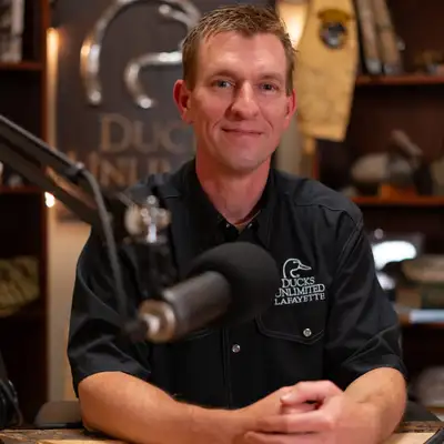
Mike Brasher:Hey, everyone. Welcome back. I am doctor Mike Brasher, your host on this episode, and we have, some, I I guess, exciting new information to share with regard to the waterfowl breeding population and habitat survey. We're recording this on, in in mid July. It'll probably be airing in early August.
Mike Brasher:We will be about a month out from the annual release of the US Fish and Wildlife Service. It's a waterfowl population status report, and we have joining us today two guests, one from the Fish and Wildlife Service, one from the Canadian Wildlife Service that are gonna give us some insight on some ongoing reviews of the waterfowl breeding population and habitat survey and some of the things that we might expect in future years, and a lot of exciting things to talk about with regard to this topic, some of which intersects technology, some of which intersects some adjustments to things that we might be familiar with, but I'll go ahead and welcome in our guest now, which one has been with us before, and I'll start there. That is Frank Baldwin, a wildlife biologist with the Canadian Wildlife Service. Frank, welcome back. Great to be here, Mike.
Mike Brasher:And then a first time Ducks Unlimited Podcast guest, doctor John Yeiser, a population ecologist with the division of migratory bird management in the US Fish and Wildlife Service. John, welcome to the podcast.
John Yeiser:Thank you very much for having
Mike Brasher:me. Yeah. So today, we are gonna talk about some ongoing work, ongoing discussions that your respective agencies are involved in. It is going to revolve around the annual waterfowl breeding population habitat survey. We're gonna get to that in a moment.
Mike Brasher:We'll start that discussion. John, you being a first time guest, I want you to introduce yourself to the audience. Frank, we've had you on before, so we'll spare you the introduction. But John, tell our folks a little bit about yourself and what you do as a population ecologist for the Fish and Wildlife Service.
John Yeiser:Sure. Yeah. So I have been working with the service since 2021. And so my current role, I'm in the division of migratory bird management, as you said. And then my branch specifically is the assessment and decision support branch.
John Yeiser:So we're very technical group. We're the ones who are running the population assessments for waterfowl that informs, you know, our our duck harvest management policies. And, you know, I do a lot of quantitative ecology and and really interested in remote sensing for wildlife management. And, yeah, again, our our group does a lot with decision science. So I work with Flyway Partners to maintain these decision frameworks.
John Yeiser:And, yeah, we we run these assessments every year. And for this review, you know, I'm I'm involved a lot in the teams that are working on revising the analytical approaches and developing the objectives of the survey and and stuff like that. And so, yeah, that that's kinda matches my background. You know, I I started my career as a wildlife biologist for the Kentucky Department of Fish and Wildlife Resources. I was just a biologist in the research program.
John Yeiser:I was there for a year and a half. It was a really great experience. I kinda got to go around the state and and work with different folks on their projects, in the field and and helping them with their analyses. And, yeah, I ended up doing a lot of upland game bird work, which led to my PhD at the University of Georgia, and I stayed there for a while as a postdoc as well where that whole time was really focused on trying to understand how these broad conservation programs, private land conservation programs affect bobwhite quail and other grassland birds. And so started, you know, really getting interested in the quantitative aspect of that and the decision making aspect of that, which I think, you know, led to the the position I'm in now.
John Yeiser:And so, yeah, it's it's really interesting to me. It matches what I'm you know, with my training and background and stuff. So I've really enjoyed it so far.
Mike Brasher:John, I'll make some connections between, you know, kinda what you described and what our audience will be familiar with. Many of our the folks that listen to the podcast will be familiar with things like adaptive harvest management and harvest models. They'll have heard us talk about banding data, they'll have heard us talk about some of the harvest surveys, the harvest information program, the parts collection survey, I. E, the wing bee, those different sort of data collection, and certainly the Waterfowl Breeding Population and Habitat Survey, these data collection efforts that produce vast quantities of data, you are one of the people that toil away day after day behind your desk, behind your computer, dealing with and using all of those datasets to make good decisions, you use those adaptive harvest management models, and you refer to those as decision frameworks. When you say decision framework, you're talking about sort of the structured, agreed upon set of models and rules and objectives that that are the basis for annual duck harvest regulations, whether we're talking about Midcontinent mallards with Midcontinent whether we're talking about Western mallards, whether we're talking about the multi stock management that occurs in the Atlantic Flyway or the new Pintail Model, those are decision frameworks, and then you are one of the people that collects, that uses all of that data, runs it through those models, and then looks at that data and those summaries relative to those decision frameworks, those harvest models, and helps develop or sort of communicates those annual recommendations, right?
Mike Brasher:You and Scott Boomer and several other people, you're one of the folks, a lot of times y'all get people criticized, they quote just the Fish and Wildlife Service or the Feds, and I always get sort of sensitive about that because whenever I hear that, I hear them criticizing people like you, but if they knew you, knew your skills, your capabilities, your interest, your sincere interest in this, they wouldn't be making those criticisms, you know, and so I just want to kind of put a name and face and voice to the people that are doing this work, and so I kind of captured what translated what it is that your role as hunters would understand it, right?
John Yeiser:Oh, absolutely. Yeah. I appreciate that. That was a great summary of what we do, and I'm really a beneficiary of a lot of work that happened before I got here to develop those, yeah, those kind of structured decision making frameworks that we use. And, of course, I'm also the beneficiary of all the people who are collecting those different streams of data.
John Yeiser:And, yeah, I'm one of the people who kind of put it all together and kind of I'm a steward of of those decision making processes now. So I work with those flyaways to make any updates as necessary and just make sure we're doing our best to get it right every year and update our understanding of of, yeah, how how how many waterfowl are out there and and what we can do with our our, hunting seasons. So, yeah, I think that was a great summary, Mike.
Mike Brasher:Yep. And so then, Frank, on your side, you know, I think there's a lot of this that, I mean, is admittedly a bit when we talk about harvest regulations, how they're set between The US and Canada, there are a lot of differences, some of which can lead to some confusion in how things work, and a lot of that is understandable. But maybe kind of set the stage, because we're going to talk about the waterfowl breeding population and habitat survey here in a moment, but I guess it might help if you provided sort of a very high level distinction between, or comparison between, what happens within the Canadian Wildlife Service and setting harvest regulations and how you use all these data, and and the similarities, and then what happens with the US Fish and Wildlife Service, like, you guys don't use the adaptive harvest managements, the same adaptive harvest management model that we use in The States, but you use many of the same datasets. So perhaps at a high level, can you help tease apart some of that, give people an understanding of those differences and similarities?
Frank Baldwin:Yeah, certainly. Suppose I'll start with the the similarities is we have a great relationship with US Fish and Wildlife Service and the flyaways, and we partner in the collection and maintenance of all these long term datasets. So that's the biggest similarities that our objectives are very similar. We want to see sustainable healthy populations, sustainable harvest from those populations, and we want to maintain the sources of information that have really made you know, Waterfall the envy of many other harvested species. And so I guess that's our biggest similarity.
Frank Baldwin:Where our differences lie is in our regulation setting process. We are signatories to some of the same plans. So we do use for management of black ducks in Atlantic Canada. We also are signatories to some of the same Arctic goose harvest strategies in Central Mississippi Flyway. And then there's some differences mainly in in in how duck harvest is is managed in Canada.
Frank Baldwin:So we have a biennial process where we propose regulatory changes every two years. We publish our own status report every two years and we work with the provinces on proposing different amendments over that time span. Importantly, we also work with a lot of indigenous partners and so our role in producing status reports is really to demonstrate to the Canadian public that the harvest that's occurring from these different populations is sustainable and that we understand the current trajectory of these species. So while we don't have as many harvest strategies in Canada as as what there is in The US, We value the information that we collect the same and strive to report on the status of these species in a in a timely manner for people to make their own evaluations on the the current state of things.
Mike Brasher:And so when we're talking about the data collected, you know, Maypond count data, BPOP data, when we're talking about band recovery data, those data sets are the same ones that are, those are the same datasets that the Canadian Wildlife Service uses and the US Fish and Wildlife Service and a lot of state agencies and researchers use, these are shared datasets. There are differences in how each of our
Mike Brasher:countries estimates annual waterfowl harvest. Well, least they're different programs, they're very similar approaches, but they're kind of managed separately. But I guess the point is that, as you've emphasized, Frank, there's a lot of shared interest in co management of these datasets, and then obviously the populations and the harvest regulations that apply to these populations. So anytime your groups, your agencies think about reviews or modifications to any of these data collection efforts, it has to be a collaborative effort. Everybody that's involved in collecting the data and curating the data has to be part of that discussion because it's a shared dataset that is used to inform all of these decisions, and so that's why it's very valuable and essential to have both of you be part of this conversation to help emphasize that, the collaborative nature around every aspect of this.
Mike Brasher:I want to go ahead and get into the topic here, an ongoing review and potential forthcoming adjustments to the waterfowl breeding population and habitat survey to orient folks. John, I wonder if you could start by reminding us of the significance of this survey. Most folks may know it as the BPOP survey. Its technical name is the waterfowl breeding population and habitat Survey, and if you think about the words in that title, it's because it collects data on the population aspect of, it collects data on waterfowl populations, as well as some elements of their habitat. So orient us to the significance of those data, what they're used for, and then we can also talk about the scale of that survey.
Mike Brasher:Without going into all the gory details, we could be here for an hour just talking about it.
John Yeiser:Sure. Yeah. I mean, it's an astounding survey, really. It covers such a huge area. You know, the prairie potholes, the boreal regions in Western Canada and Eastern Canada, you know, a little bit into the Arctic Tundra.
John Yeiser:So it this there's just spatial scope of it is impressive in itself. And, you know, our our survey strata just, I think, cover about 20% of North America. So we're trying to estimate that amount of area on an annual basis. And, you know, it it's been going since you know, officially since 1955, I believe, is when it kinda consolidated into an official survey. And so just the breadth and kinda depth of this survey is unprecedented in wildlife sciences.
John Yeiser:Like, it it's you just don't really see it often, and it's a wealth of information. You know, we we obviously use it to inform adaptive harvest management. You know, we also use it to inform conservation goals, you know, for and and stuff like that. And, you know, there's been countless scientific publications that leverage this dataset. And, you know, it's just a unique thing, and and it it really does have a great impact on wildlife ecology, our understanding of what sorry, waterfowl ecology and and these adaptive harvest management frameworks.
John Yeiser:So
VO:Welcome to the Old Timer Minute sponsored by Old Timer Knives.
Mike Brasher:My favorite memory of Old Timer Knives takes me back to when I was a kid growing up in small town Mississippi. My grandparents and my parents after them owned a hardware store, and one of the most, indelible memories of that was the the knife case they had, displaying all sorts of knives. And of course, timer knives were a prominent feature of that. I had several growing up. So the most lasting memory, however, would have to be the old timer knife that that I inherited from my father when he whenever he passed away.
Mike Brasher:It's one of the little sort of brown wood three bladed knives, pocket knives, remember him sitting around at Christmas always pulling that out to to open up Christmas presents, cutting the tape. And so fantastic memory of Old Timer Knives. This has been your Old Timer Minute brought to you by Old Timer Knives, built for generations.
VO:Visit the oldtimer.com.
Mike Brasher:Frank, with regard to the review that we're gonna talk about, like, what what prompted the review? And also, we kind of get into this, feel free to acknowledge the other groups, the other entities, the other people that are involved in the review, the different teams, but why? Why now? Why is the review being undertaken for this most important survey?
Frank Baldwin:Well, like many programs, periodic reviews are really essential. You wanna make sure that your your objectives have remained the same, that you're keeping pace with any system changes that might be going on, that you're making use of any technological or analytical advances that might be taking place and that you're doing the work as efficiently as possible. So like many folks listening that might be, you know, involved in business or or other programs, review is just a part of, you know, the the workflow and the program and the the survey has gone through reviews in the past, couple three sort of fairly major reviews that focused on different aspects of analyses, spatial coverage in some cases, your visibility correction factors, things like that. And I guess the big difference with this review is just the entire the the breadth of the scope, everything from objectives to technical aspects to spatial extent to the issue of sex ratios, which we'll probably get in a little bit later. So so I I think that's really the difference here and then for me, what's really noteworthy is the what's just been accomplished in a relatively short period of time.
Frank Baldwin:So we've really been working on this for just over a year and a relatively small group of people across both countries and just and and not just in in government, across academia also. And just what's been done so far is really astounding. And so we're sort of at the point where we're we're getting some results. John's involved in a in a lot of that work, conducting some simulations, not making any decisions just yet. But the amount of work that's already been completed is is quite amazing in one year.
Frank Baldwin:And I think the folks that originally conceived that the survey post war would be pretty proud of the review that's been undertaken so far.
Mike Brasher:Yeah, I think that's a good point to kind of to harken back to the originators of this survey. I'm wanting to think about how long it has been sustained, The length of time over which the original methods, the original approaches that were conceived in the 40s and 50s, became operational in the 50s, have carried us, what is my math now, like seventy years into, over a seventy year time period. That's ridiculous to think about, that some methods designed seventy years ago were so well conceived, so well thought out, the understanding of the system was so good at that time that the methods that ultimately, that were decided upon seventy years ago have carried us this far, and with some periodic tweaks, but largely, I don't want to say unchanged, but largely very similar to the way they were originally designed, and as you said, periodic reviews are always important regardless of what it is that you're doing, we now find ourselves in a time where things are advancing so rapidly, technology and technological applications are expanding, advancing at a rate that none of us have ever seen before, and there's all sorts of new opportunities and new methods for collecting data remotely, satellites, drones, you can even, a lot of folks will know about even the sort of the acoustic recording devices.
Mike Brasher:There are so many remote data collection methods that are out there now that this is certainly an exciting time to be undertaking this review because a lot of the discussions intersect some of those topics, but there's also just some more fundamental aspects of this waterfowl and waterfowl habitat system that are demanding a review as well. Frank, you mentioned one of those. The other thing that you haven't mentioned, but is a reality, anytime we're investing in some type of data collection effort like this, or any type of effort, is that it takes resources to do this, and anyone that has followed the news knows that resources for government activities, for government programs is increasingly difficult to secure, and the agencies that we work with, US Fish and Wildlife Service, Canadian Wildlife Service, are not exempt from that, and that's something I don't expect you to talk about. It's something that we've talked about and acknowledged on previous episodes, all of the state federal agencies at some time or another face resource constraints, and this is one of those times, and so there is a very pressing need to find ways to increase the efficiency without sacrificing the effectiveness of the data that's being collected, and so that's sort of where we are in this, and it's good to hear you point out that there's more than just our government agencies that are involved in this, we've got some university researchers involved.
Mike Brasher:Looking back over the seventy year period, John, maybe I'll go to you for this one. What's an example of one of the more significant and notable revisions that had occurred in the past, and what were the type of things that undertook?
John Yeiser:Yeah. We have a pretty rich history of going through and reviewing and revising the survey. So there's kind of been four, I would say, four major reviews or revisions. So in the seventies, 1973 is is there was kind of a step back moment where, you know, our agency took a look at what we were doing and and we thought about, are we doing the right thing? And are we getting what we want out of this survey?
John Yeiser:What are the issues that we're running into? You know, how can we maybe get better at that over time? And so that was a pretty seminal review and pretty comprehensive. And after that review, we kind of consolidated before that period, they were in the traditional survey area, there was, you know, the the survey going on in the Prairies and the survey going on in, like, the Boreal or the the bush area. And after that review, they consolidated how we sample.
John Yeiser:And moving forward, you know, as you mentioned, since that time, we've basically kept that same design until now with some tweaks along the way. And then in the eighties, we kind of it was a less comprehensive review, but it was, you know, a little bit more technical. It's all about how can we improve efficiencies. And a lot of, you know, these these historical reviews were focused on these visual correction factors, like making sure you're understanding how many waterfowl you're missing from the air based on where, you know, the the waterfowl you count on the ground. And so, you know, continuing that in in the nineties, there's a review, mid nineties that, again, took took a look at all of the issues that were brought up in previous reviews and made some, excuse me, some recommendations on how better to sample, you know, from the ground or how to to better estimate these visual correction factors.
John Yeiser:And then that review set up what we did in the Eastern Survey area in the nineties. And so that's when we started bringing on strata in Eastern Canada to try to get a better understanding of, you know, where black ducks were and and and other species in the East. And that yeah. And and even in that short time or relatively short time that they the Eastern Survey area has been online, we've made several improvements to the analytical framework there. So, really, it's it kind of it started really broad in in the seventies to kind of this comprehensive review, and then it kinda it started to narrow over time to just try to get more and more efficient.
John Yeiser:And I think the review we're undergoing now is it's a it's a combination of of each of those things. You know? We're we're being comprehensive. We're taking the step back again. We're, you know, reviewing our objectives.
John Yeiser:We're we're really honing in on the why of of this survey. Like, what do we wanna get out of this going forward? And, you know, that's guiding the kind of the rest of our technical discussions about which models should we consider, you know, which design should we consider, how how do we prioritize species. All of those things come together in in a under that comprehensive vision of of trying to figure out how we're gonna, like you said, get the most efficient use of our resources going forward so we can still continue to make informed decisions.
Mike Brasher:And so I might ask you to unpack that a little bit because, you know, I'm gonna state a fact here, and that is resources are limited, and everybody knows that. It is not possible to build a Cadillac version of a survey with maximum coverage of all the breeding areas where we find waterfowl. That's just not possible. We don't have the resources available to do that. Never had the resources available to do that.
Mike Brasher:That's why we use a statistically based survey design to help us estimate with high levels of precision waterfowl populations across vast areas, so that there are limited resources is just a fact, and so the challenge that any wildlife manager, wildlife scientist, wildlife decision maker faces is how do we get the best data available to inform the decisions that we have to make for managing these populations subject to what we anticipate being available resources for doing that. So that is just sort of a stated constraint that we have to operate within that. And so, John, whenever you said, what do we want to get out of this? Most waterfowl hunters and people that are interested in this survey will just think about, well, we wanna know how many waterfowl are out there. We wanna know how many ducks are out there and how many geese are out there.
Mike Brasher:But how does a group, how do people like you think about that differently? You mentioned some of it in prioritizing species, but what does that mean? And how do you think about what you want to get out of this?
John Yeiser:Yeah. Great question. And essentially, it's it's a lot of what you just said. I mean, we obviously want to be able to estimate the number of waterfowl that are on the landscape. I mean, we want precise and accurate estimates.
John Yeiser:With with the resources we have. You know? So it's a bit of a it's just an optimization problem. And you stated it well. You can't, you know, maximize your effort and get perfect estimates for every stock out there.
John Yeiser:Even if we had 10 times the budget, you know, that probably wouldn't be possible. So, yeah, part part of this decision making well, first of all, we we were taking the structured decision making approach, the same kind of concepts and foundational approach we use for adaptive harvest management. So that's helpful. Like, we we're establishing our objectives. Like, you know, I'm not we can't go into all the discussions, but as you can imagine, they're revolving around getting those accurate estimates and staying within our limited capacity.
John Yeiser:Right? That's kind of the main trade off. And so, yeah, a a part of a part of figuring out which estimates we need to get right or, you know, do the best our best job at kinda reducing uncertainty around is that prioritization process. So which stocks do we maybe need to get more information on in the future compared to what we were doing in the past? You know, we we can we leverage this this really long timeline to maybe push forward some estimates of species we have really good information on and shift effort towards other ones that we need information on.
John Yeiser:So, you know, that's one way where you start to whittle down the decision a little bit. And then another way you can potentially increase efficiencies is now we we've been using the same estimation framework for for decades, and it's, you know, really useful. It's really effective, but it's not the most robust process. This the estimation framework we use now, and it's just specifically in the traditional survey area. There's been a lot of advancements, you know, even over the last ten years on how you can analyze this type of data.
John Yeiser:And so we can maybe makes get the most out of our information that way as well by by trying to modernize our analytical approach. And then, you know, to your point about technology, that's part of it. You know? Just the analytical techniques we can use now. And then there are emerging technologies like remote sensing that, you know, we just we have as a priority in our division.
John Yeiser:It's just that we're a little further away from implementing those technologies to put inside of this review. So this survey review, I mean, we're we're definitely thinking about that stuff, but it's I, you know, I don't expect there to be an, you know, a major change in how we incorporate remote sensing or anything like that. But, you know, just because it doesn't make it out of this review and, you know, I it doesn't mean that we won't focus on that in the future. We just kinda have to do what we can in the timeline we set for ourselves. So it's it's super complicated.
John Yeiser:I mean, there's so many moving parts. It's a huge survey, like we said. And so having this kind of structured decision approach is really helpful to just kinda keep us on on the right path and and consider the things that really help us achieve our objectives going forward.
Mike Brasher:And that's one of the reasons why it takes so long to get through this as well. It's just a lot of things to consider, a lot of decisions to be made along the way, a lot of alternatives that can be considered. Frank, John mentioned that one part of this might be prioritizing some species over the other. Are there some aspects of that that might relate, and I think John touched on this, but I want to unpack it a little bit more, are there some aspects of that species prioritization that may say, okay, these are really important to get a good handle on because they're very influential in a harvest model, but then what about species that may be of a higher conservation concern because of a low population status? Are both of those things at play whenever you're considering species prioritization, or are you putting more weight on consideration of species because of their importance in harvest decision frameworks?
Frank Baldwin:No. I would say they're they're definitely both at play, and one of the major advantages of this review is looking at how we can make efficiencies, not just in how we collect the data, but how we can integrate different data sources. So that really plays into the question about how how how the review affects some of the the species or populations which are, you know, really important for conservation reasons, but which maybe have a more limited amount of data. Could be banning data, could be low observations and surveys, or or really, you know, specific remote areas where they nest. I think there's a lot of potential advantages in improving our efficiency by using these other sources of information that we've relied upon for years.
Frank Baldwin:So speaking about banding data, harvest survey data, and then using some of the modern approaches to leverage the long term data that John mentioned for some of the more common species that we may band or have a good understanding of you know, their age ratios or productivity throughout the years and then applying some of that vast amount of data to species which are have, you know, are maybe poor monitored. More poorly monitored, sorry. So I think that is gonna be the main benefit that we see across all of the species that we monitor is really the full integration of our banning data, our harvest data, and our population survey data. And I think that really serves other purposes too. It really improves its resilience to different pressures that it might face.
Frank Baldwin:Could be budgetary pressures or it could be, you know, environmental pressures, know, years when we can't survey areas because of forest fire smoke or pandemics, things like that. So really finding ways to improve our efficiencies with the data that we have in hand, not just in the way that we collect it, is a foundation of this review.
Mike Brasher:That's a scary thing to to think to hear you say we can't do surveys again because of a pandemic. I'm like, I don't wanna go back there. I'm sure there's a lot of people who say, I don't want you to not be able to do surveys because of wildfires either, I understand that, but in terms of the idea of a global pandemic again, it's like, holy smokes, I hope we never have to deal with that, but regardless, there are other more likely scenarios, constraints, and pressures that will emerge, and there's some parts of it, we were talking before we started recording that there are some parts of this annual data collection process that are threatened in one way almost every year. This year, there's banning operations that can't occur in some northern regions of Canada because of the wildfires in Ontario, not necessarily because of areas are threatened by those wildfires, but because equipment in the form of aircraft, helicopters, and so forth are not available to do those type of data collection efforts this year, and so yeah, that's just in terms of building in resilience to all sorts of, I guess, unforeseen circumstances that in one way or another seem to crop up in one place almost every year.
Frank Baldwin:Yeah. No, I'd just add to that, Mike. I think that's the characteristic of, you know, what we want to see in the future is something that's precise, has robust, and and, you know, which allows us to to generate information when we're when we face challenges. And the the only reason I I mentioned that the pandemic is that that those are the only two years since 1955 that the surveys didn't happen. And despite all of the other challenges, you know, faced in in other years, you know, it's been pulled off every year but those and and so that's that's it it's it's one of the objectives is to make the approach resilient to any challenges we might face in the future.
Mike Brasher:Guys, we're gonna take a break right now, then we're gonna come back, and I'm gonna I'm gonna I don't know how much you're gonna be able to tell me, but I'm gonna press you a little bit on seeing what you can tell me about the different alternatives that are being considered and what we might be able to share with folks in terms of the things that could happen, the things that a review might lead to. This is a survey that a lot of our listeners, waterfowl hunters, interested in, and the primary reason why we're having this conversation is that if there are changes that come about next year and they hear about those, they're not surprised by it. They know this review is ongoing, and there's a lot of thought being put into it. So I'm gonna see what you're gonna be able to tell us whenever we come back. So stay with us, folks.
Mike Brasher:We'll be right back.
VO:Stay tuned to the Ducks Unlimited Podcast sponsored by Bird Dog Whiskey after these messages.
Mike Brasher:Welcome back, everyone. I am here with, Frank Baldwin, wildlife biologist, Canadian Wildlife Service, and Doctor John Yaiser, a population ecologist with US Fish and Wildlife Service. We're resuming our discussion about an ongoing review of the waterfowl breeding population and habitat survey. We've laid a lot of the groundwork and justification why this review is ongoing and how it intersects potential new technologies, new analytical advancements, and overall just trying to move forward with a better system that still provides the data needed to inform harvest decisions through the harvest models that we've been working with for a number of years, new ones that are likely to come just as a natural outgrowth of continual evaluation and understanding of waterfowl populations and harvest dynamics, and so these types of things, discussions, questions are always being asked and answered, and maintaining good, reliable data sets to inform those discussions is super critical. So I know you guys can't, I know no decisions have been made yet on any of the, quote, changes that may occur or revisions that may occur.
Mike Brasher:Are there certain alternatives, certain ideas? Frank, you mentioned that integrating multiple datasets might be something that might happen going forward. Are there any examples of ideas, understanding, I want to be very clear here, no decisions have been made, but I just, I know people are interested in this. Is there anything that you can share about These are some alternatives, alternative ideas that we're exploring. Frank, I'll go with, I'll go to you first.
Frank Baldwin:Sure. So one one thing that's definitely something we're exploring because it's one of our technical teams is looking at the influence of sex ratios and how we use, you know, some of the assumptions that we've used in the past on, you know, what our observations of of ducks mean in in these surveys. So just for some context, really since the advent of the of the surveys, biologists have been forced to make assumptions about what these different social groupings of ducks mean in terms of whether lone drakes or flocks of drakes have a a hen that's, you know, nesting in cover and is unobservable. And so for many years, we've made these assumptions that lone drakes, less than four Drakes all all have all have a hand and so the data that we've had have been expanded to to account for this and we've struck this technical team to investigate this and this is really one aspect of the survey that relies upon the integration of data. So we we don't have to make these assumptions necessarily anymore, we can estimate them directly.
Frank Baldwin:So using banding data and using harvest survey data, we can estimate the sex ratio of the population at different times of the year. And that's really important because we're gonna deal with an assumption that we've been making for a long period of time which we know can have some impact on on the estimates and importantly, we can deal with one of the big issues which is survey timing and phenology. So survey timing and phenology can have an impact on on how we count ducks, so it can change the social groupings of these birds, which can then change population estimates. But importantly, phenology is really difficult to deal with any in in any sort of operational way. It's really challenging because of the expanse of the survey area and the number of crews involved to time the survey absolutely perfectly every year.
Frank Baldwin:And so one approach that's being considered is is using estimates of the the pre breeding sex ratio for different species to to directly adjust data. And I'd say that's a pretty major change from the past, but it's something that the communities, the waterfowl research community, the management community has been interested in a long time going back to the nineteen sixties when this was a focus of of past survey reviews, but there wasn't the analytical approaches that are available today to address it.
Mike Brasher:Yeah. Frank, I'm glad you mentioned that. We just had an article out in the Ducks Unlimited magazine sort of introducing, talking about sex ratios and their importance in estimating breeding duck population size, and even alluded to the, or talked about the shift to the increasingly male biased sex ratios that are being observed in some duck populations and the implications of that for population estimation, as we're talking about here. So that's great that you mentioned that. The other thing that you mentioned that you highlighted is that, you know, now banding data and harvest data are being used in that part of the population estimation equation, and so what that means is that the ability to accurately estimate harvest and to get reliable banding and band recovery data is even more important now than it ever has been because it is featured in so many and being used in additional parts of this larger analytical decision space, analysis and decision space, and so in the position that I'm in, I sometimes hear people talk about how they are apprehensive about reporting their bans because they think that if they don't report their ban, they're going to somehow skew the results in a way that would be favorable in their mind with regard to how it's used in some decisions for harvest regulations, and my plea is always to don't report your ban, don't assume that you think you know what a certain decision to report or not report a ban has on some part of an estimation framework or estimation method, and certainly now, because it's used, or going forward, if that were to happen, the way in which those data are used and the bias that could result from intentional non reporting could manifest in numerous unforeseen ways that are just totally unknown to people that think they know what's going on, so it just increases the importance of accurate band reporting, harvest estimation, so when you're asked to participate in any of these surveys, we plead with you to do so, provide the data that's so valuable, and let these guys do the analytical work to make the best decisions possible.
Mike Brasher:I mean, that a fair statement, Frank?
Frank Baldwin:Absolutely. I think for a very long time, they've all all of these sources of data or the three legs of the stool have made important contributions to managing harvest of these populations. And in the future, and and and there's many some recent examples, the the integration of the three of them is just going to produce even even, you know, better information. And so, yeah, we know that sort of one integrated stream is a lot better than three independent streams, and I think that is gonna be, you know, one of the major advancements in in in this overall.
Mike Brasher:So, John, we talk about when it comes to waterfowl distribution during migration in winter about how there have been certain changes. We've documented some of those changes through various datasets, band recovery, and it's the changes in winter and spring distribution, and timing of spring migration have been documented in other groups of birds as well, and so we know that things are changing with regard to bird, duck, waterfowl distributions, and the timing of some of those distributions, and are there do we have information on any type of similar or suspected changes in distribution of breeding waterfowl, and is any of that being considered in some of these potential revisions? And I guess what I'm getting at is, is it fair to think that one of the many alternatives being considered as part of this revision might include, well, maybe we need to increase or expand our survey effort in these areas because of changes in distributions of species or certain species that may be of higher importance for some decision frameworks now than before. Is any of that sort of shift in survey effort being considered?
John Yeiser:So I would say, you know, there are many aspects of the survey that are being reconsidered here. And let's step back just a second because, you know, you're right. We haven't made any decisions about alternatives or anything like that. But, you we've made good progress on, you know, what we think our primary objectives are, and we are focused on on, you know, making sure that any decisions we make are beneficial towards that you know, meeting that objective. So, you know, you could imagine if we estimate that distribution has shifted or that our priorities are changing based on where the strata have been or historical effort has been or even for the species we still really care about, but maybe we just don't need as much sampling in that area to get the same quality of estimates given the other improvements we're making.
John Yeiser:Right? So they're all connected to each other. And so, yeah, you can imagine an expansion of the survey area or contraction perhaps or just changing where we're sampling, changing the way we sample potentially. You know, you're talking about the intensity of effort from the air versus on the ground versus can use a helicopter. You know I mean?
John Yeiser:Like, just the the the frame of the the sampling itself. And, again, you know, these decisions are gonna be made in context of what we're trying to achieve. And without getting too technical here, one one thing, you know, I mentioned that the our analytical approaches have evolved quite a bit over the last several decades, and that's true for how we analyze the data. That's also true for how we can conduct this review. So what sets this reviewed apart from the previous ones is that, you know, we're we're coming up with a way to estimate the you know, what we think the bias in our current design is, and then we can compare that to any new designs that get, you know, analytical approaches that get proposed.
John Yeiser:And so we are trying to quantify exactly how well each proposed design does in meeting these objectives. You know, we've come up with these these different values and attributes that we're gonna measure from from these quantitative or these methods we're developing, and those are our yardsticks. And so, you know, the final decision is gonna be based on comparing whichever alternatives we we come up with and how well they meet those objectives, like in a quantitative way.
Mike Brasher:So I think you're saying that if I I'm somewhat familiar with some of the work, and I'm not, again, no decisions have been made, and so I'm But I think you're saying that, like, in a perfect world, we would come up with alternative designs, and then you would implement those at the same time across different, you know, different spaces, and then you would see how one performs relative to the other, and also in a perfect world, you would know how many ducks are out there to begin with, and you'd be able to compare the estimates that result from the different designs and their spatial scale, but of course, we don't live in a perfect world, we don't have that information, so you're using some simulation exercises to say, under these simulated sort of landscape population habitat conditions, if we implement these different survey designs, how do they perform? And because simulation, you know what that simulated population size is, and so then you do the comparison of those alternative designs. Is that am I getting close?
John Yeiser:Yep. Yeah. You nailed it. I mean, that's it. And so, know, you're never gonna be able to simulate the the system perfectly.
John Yeiser:Right? So there's always a little bit you're not gonna know and, you know, a lot of it you're not gonna know. But, yeah, that's the goal is to try to use the most current information that we have available to us. You know, that could be multiple data sources to say, here's where we think, you know, birds are now across the landscape, and that's our measuring stick. And then we can simulate these different designs.
John Yeiser:So we can say, okay. We have design a, b, and c. Let's simulate that sampling process for fifty years into the future and say, okay. This one is pretty good. This one's not so good.
John Yeiser:You know what I mean? Make make those comparisons. And, you know, it's a very common kind of approach to sampling design questions. And so, yeah, we're we're you described it well. I mean, you're essentially trying to create this yardstick that you're comparing your current design and any future designs to.
John Yeiser:And, you know, the benefit of forecasting into the future is that you can say, okay. Well, what if the system continues to change? Which design is best for that? What if sex ratios continue to change, or what if they level out? You know, we can we can go through these hypothetical scenarios, and, you know, it it can you can multiply those pretty quickly, so we have to limit ourselves here.
John Yeiser:But, again, it's all tied to those main things we want to to those main trade offs we want to try to figure out.
Mike Brasher:And one of the ways that I think about this, when we talk about alternative designs, alternative survey designs, and I don't know if this is part of what's being considered. I think you mentioned that it might be it's sort of in the realm of what you would think about, but this is the way, sort of the best example that I would give someone that I'm talking to with regard to, in describing what I mean by alternative designs. When you look across the broad survey area, the traditional survey area and the Eastern survey area, let's just talk about the traditional survey area, it's broken up into a number of strata that correspond to broad regions of general similarity habitat type and habitat, you know, land cover and things of that nature. And even within The US, within the Prairies, there are a number of strata that correspond to differences in pond density and perhaps duct density and things of that nature, and when you look across those strata, there are different densities of survey transects. Not all of them, like some of them, we have two to three times the number of transects on a per area basis that we fly, because those areas have higher densities of wetlands, higher densities of ducks, you want more precise estimates in those.
Mike Brasher:So we have, in the current survey, different densities of transects across the strata. One of the things that might be considered is, well, can we reduce some of the densities of survey transects in some strata and reallocate those survey transects to other areas, or maybe expand some of those survey areas if we have new information from recent studies that suggest ducks are nesting in areas that aren't covered as well, then maybe we think about an alternative design that reallocate some of those transects. I don't know if any of that is actually being considered, but that would be the best example of an alternative design that I could give folks, and so it's those types of things, along with everything else that you've hinted at that are being considered, that I would think are being considered here. And so we've talked a lot about what that might mean from the duck standpoint, but Frank, what about habitat standpoint? Within the prairies, when the surveys are conducted, they're counting ducks, but they're also counting ponds, that's the May Pond Index.
Mike Brasher:To what extent is this review considering alternative ways of assessing habitat condition, either in the prairies or more broadly in areas that currently we don't get sort of data based assessments of habitat condition?
Frank Baldwin:Yeah, so I think you might say that ponds are sort of being evaluated similarly to to Ducks are in the in the survey design, but also in the background, there's a number of people who are looking at different ways to estimate pawn numbers using remotely sensed data. But just important to mention is the fact that the work that's conducted throughout this area annually, anytime you're using remotely sensed data, you need ground truthing. And we have, you know, a huge time series of ground truthing which is conducted on an annual basis of tens of thousands of different wetlands. So we have really the potential to use more modern approaches using remote sensing, but also the requirement for adequate ground ground truthing information. So I think it it is considering it and considering advancements and importantly, we we have the information in place to provide the, you know, huge amounts of of of data to make sure that those that, you know, decisions made using remotely sensed data are accurate.
Mike Brasher:John, anything to add to that?
John Yeiser:Well, broadly, let me say, you know, we're talking about all of these potential changes to the survey. I just wanna state, you know, one of the stated objectives of this review process is to maintain continuity in our time series. So I just wanna make that clear. And then, yeah, with the remote sensing or sorry, the the pawn counts and and and that, yeah, I think there's a ton of of potential there for a remote sensing product to supplement or, you know, maybe replace the way we we count now. That that you know, those questions are still being asked and trying to figure out a way to do that efficiently.
John Yeiser:You know, as promising as remote sensing is, you know, we operate under a really tight timeline, you know, from when the birds are actually on the landscape to when we sample them and turn it over into estimates. So, yeah, any implementation of remote sensing workflow would have to take that into consideration. And when you consider, like, the just scope of our survey, you know, there's a lot of questions to be answered still about, like, where where do you need it? Where do you not? You know, just kind of how can you optimize that part of it, which is kinda why it's not fully being explored in this review just because it's so it would be such an intensive task, I think, that it just goes beyond the scope of it.
John Yeiser:But, again, like Frank said, people involved in this review have a lot of experience with the most insane and can add some really good insights. And that's not to say we might not just, you know, incorporate it in other ways, but as far as, you know, counting pawns right now, we're kind of treating it as we are any other duck. It's something we want to keep track of and make sure we're estimating properly with our current methods. Yeah.
Mike Brasher:I think a lot of people would say, oh, well, the pond count element of this ought to be simple. It's like you just use remote sensing, use satellite imagery to count the number of ponds in place of sort of human observation of ponds, but it's not that simple. When you understand, like, so the pond count is just sort of an index of habitat condition that has a known effect on the annual recruitment, the productivity of the ducks that breed in that landscape, and then that number, made pond count, is important now in those harvest models because it's sort of the index. It feeds a model that tries to project productivity, which then works through the different population models within the adaptive harvest management arena to help inform what is that optimal regulatory package for a given year. And so, getting to Frank's point about you have to have ground truth data, you can't assume that a remotely sensed estimate of pond count is going to match one to one with a human observation count or estimation of pond count, so you would kind of have to, you'd have to figure out what that correlation is or what that ratio is, but then you would probably even want to back up and say, if we were doing a remote sensing assessment, is there something better than pond count to help us index habitat conditions and productivity that feeds through that model, that then informs our regulatory decision process?
Mike Brasher:So it's not just simple when you get deep into the decision making that you guys deal with for harvest regulations as saying, well, let's just use remote sensing to count ponds. Am I right, John?
John Yeiser:Yeah, exactly. I think conceptually it's really simple, and then operationally it just gets more complicated. But I'm not saying it's not possible, it's just we got to, you know, there's things to figure out. So
Mike Brasher:we're going to start wrapping up here. I'm going to give you guys an opportunity to offer anything else here in just a moment. But first, Frank, I want you to offer what you can about the timeline. When would waterfowl hunters, when would waterfowl managers, when should they expect to start hearing things about what changes may have been decided upon? You know, whatever those changes may be, however significant, insignificant they may be.
Frank Baldwin:Well well, I think we've been communicating some of that already. Communication with our partners has been a focus since we started the review. So we've had a number of different meetings with Flyways to keep them up to speed on some of the work that's being done of the each technical group will be producing some reports. So we're in a bit of a we're we're in a bit of a period now where we go back to collecting data. So we did a lot of work over the winter and through the spring.
Frank Baldwin:A lot a lot a lot of the technical committees hosted workshops and then we got into field season starting in in late April and a lot of individuals are involved in either collecting the data, analyzing data, making sure that the reports and estimates come out on time. So I think some of the groups have continued in earnest over over the summer, like definitely John's group working on simulations and modeling. And then some of our other committees will pick things back up in in in September when we've got our desks clear of some of the other work that we've been doing over the summer, and we'll continue our communications with our partners. Ultimately, we're looking at a fall twenty twenty seven timeframe for for decisions, but well in advance of that, we'll be we'll be working with partners and folks such as yourself to make sure that the information gets out to to to the public.
Mike Brasher:So, John, as we wrap up, Frank, I'll come back to you with this question as well, but what else? Like, we've we've covered a lot. We've tried to stay out of the details, but but what else, what other messages would you want to convey to our listeners, most of whom are waterfowl hunters, as we as we start to close out?
John Yeiser:No. We covered a lot. And I think this is a great kind of summary and overview of what we're trying to do. And I just wanna reiterate how collaborative this has been, you know, between our two agencies, Frank, and, you know, we have other federal agencies helping us and universities and, you know, nonprofits like DU and others. And it's just been really an awesome effort so far.
John Yeiser:You know? And there's so many passionate people on this review who really care about this resource, and we're taking this really seriously. You know? So we hope to deliver a product that that helps us continue to meet our obligations, excuse me, you know, that we have to meet and and make informed decisions, and and that's what we're trying to do.
Mike Brasher:And, Frank, you get the final
Frank Baldwin:word. I would just say that the approach is gonna use the same data that we've relied upon for making harvest management decisions for for decades. It's it's gonna be using population survey data, harvest survey data, and banding data. They're really the pillars of of management. And so people should really take a lot of confidence in the fact that a central goal is maintaining all of these three programs and improving their efficiency and their integration.
Mike Brasher:Well, guys, I really appreciate you joining us to share this information. Hang on, I lost my train of thought there. I gotta redo that. That's kind of weird. Frank and John, thank you so much for joining us here.
Mike Brasher:You know, one of the things I'll point out, Frank, is that two of those datasets, the really cool thing about them is that they rely fundamentally on participation by hunters. That's not gonna change, and I'm talking about the dataset and the harvest dataset. That is not gonna change. You know, it's fair to say that, hey, there are some changes being considered, technological advancements being considered for at least one of those efforts, that's a discussion for day distant in the future, but the point that I've made a lot of times is that our partners, our federal state agencies, and even our university partners and NGO, we're always thinking about these surveys, we're always thinking about how to make things better, we're always thinking about how we can apply new technologies, new approaches, those wheels of thought are always turning. It sometimes takes a while to get them from concept to implementation, but this group that we are proud to interact with and proud to partner with are always thinking about that and those things, and this is a really exciting time, and I look forward to the next several years when we're able to help share those stories of advancements and improvements and adoption of new technologies to help us continue to do the things and manage this resource in a responsible and sustainable way, the way we've done for, I guess, a century now.
Mike Brasher:You think back to the Migratory Bird Treaty Act of 1918, and that's kind of when all this federal oversight and collaborative effort really got underway. So it's exciting to be part of the continuation of that and the future of that. So Frank and John, thank you so much for being part of that. Thank you so much for joining us and helping share some of this story.
Frank Baldwin:Thanks very much, Mike.
John Yeiser:Yeah. Thank you, Mike.
Mike Brasher:A very special thanks to our guest on today's episode, Frank Baldwin with Canadian Wildlife Service and John Yaiser with the US Fish and Wildlife Service. As always, we thank our producer, Chris Isaac, who does a great job with these episodes, and we thank you, the listener, for your interest and for sharing your time with us on the Ducks Unlimited Podcast.
VO:That's a wrap for today's episode of the Ducks Unlimited Podcast brought to you by Bird Dog Whiskey and Cocktails. From post hunt unwinds to celebrations back at camp, Bird Dog delivers award winning flavor to every moment. Enjoy responsibly. Don't forget to rate, review, and subscribe, and check out ducks.org/dupodcast for more stories, science, and all things waterfowl. Guest opinions are their own and don't necessarily reflect those of Ducks Unlimited.
VO:Until next time, stay fired up, stay focused, and stay tuned to the Ducks.