Subscribe
Share
Share
Embed
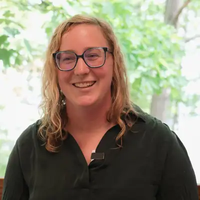
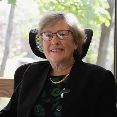
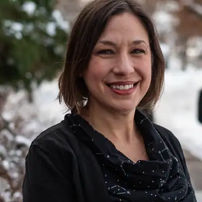
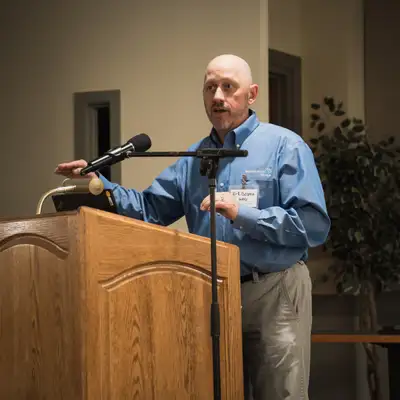

Time and Tide is a New Hampshire Sea Grant podcast for anyone who is connected to the Granite State’s waterways and wants to learn more about the latest science impacting both yourself, and the animals that live here. Hosts Erik Chapman and Brian Yurasits break down complex topics from seafood to coastal resilience by bringing on guests from both the research world, and local industries to share their expertise and perspectives.
Coastal Flood Risk Summary_MASTER
===
Mary Stampone: [00:00:00] You know, when it comes to precipitation, we're going to get more of it in individual events, and so that means more water at one time.
Anna Simpson: Right now in Hampton, New Hampshire, we observe about 10 days a month that experience high tide flooding. In 2050, so in 25 years, we'll see about twice that number of days.
So about 20 days of the month we'll see high tide flooding.
Kirk Bosma: With deeper water, there becomes more energy that can get to the coast. So it's not so much maybe that the storms are changing, but that you have more water in areas mixed with storms that might be the same as we've always seen, but you have deeper water.
You can imagine more energy getting places where it hasn't seen it previously.
Jayne Knott: Good science is so important because it's the foundation of how we deal with changes.[00:01:00]
Brian Yurasits: You've probably seen the signs along New Hampshire's coast, a road that floods more often than it used to, a marsh creeping inland, a king tide that leaves water where no one expected it. For years, we've heard about a future with more flooding, and water marching ever so further inland. Well, time keeps passing, and that future isn't so distant anymore.
According to the latest New Hampshire Coastal Flood Risk Summary, the science is clear that Granite Staters will be faced with flood risks coming from all angles. The report brings together the best available science on rising seas, coastal storms, groundwater, and rainfall to help communities understand what's changing and what those changes could mean for the places we live, work, and love.
It's not all doom and gloom, though. The science is improving, and as the saying goes, knowledge is power. I'm your host, Brian Yurasits, and welcome to Time and Tide, the podcast from New Hampshire Sea Grant, where we explore the science, [00:02:00] stories, and people behind our changing coastlines. On today's episode, we speak directly with the researchers behind New Hampshire's Coastal Flood Risk Summary as they break down the latest science on how water coming from the sky, the ground, and the ocean will change the Granite State.
Swim along with us.
We'll kick things off with Lisa Wise, who gives us some backstory behind the New Hampshire Coastal Flood Risk Summary.
Lisa Wise: My name's Lisa Wise, and in my role with New Hampshire Sea Grant and UNH Cooperative Extension, I served as the coordinator for updating the science report for the New Hampshire Coastal Flood Risk Summary.
This team included scientists who work locally and regionally on different aspects of flood risk, and a panel of external reviewers also reviewed the draft content. New Hampshire communities are dealing with more frequent and intense flooding as sea levels rise and stronger storms drop more rain. So to better [00:03:00] understand how New Hampshire's coast is changing, every five years, the state of New Hampshire updates a resource called the New Hampshire Coastal Flood Risk Summary.
The science and projections and best practices are always improving, and new issues are emerging, so it's really important that we have this resource updated regularly so that decision makers, coastal practitioners, coastal municipalities, and state agencies all have access to the best available information and resources to inform smart decision making and plans in the future.
The New Hampshire Coastal Flood Risk Summary consists of two parts. Part one, science, provides a synthesis of the latest trends and projections for coastal flood risk in New Hampshire. And part two, guidance, walks through how you can use that updated science.
Brian Yurasits: We're focusing on the science here. As someone who lives in New Hampshire, why is having good science around flooding important?
How does it impact me?
Lisa Wise: Yeah, I think what makes this really important is that it's specific to New Hampshire. There's a lot of global projections and national sources of this kind of information, and having the [00:04:00] scientists look at what that means for New Hampshire and make it really specific, and also identify those gaps and those areas of emerging concern.
The decisions that we make today will impact development and land use planning for decades, centuries into the future. And so it's really important that we, again, have that best available science to make the decisions that will keep people and property and natural resources safe going forward.
Brian Yurasits: As you'll hear, flooding comes in different forms here in New Hampshire.
Up next, you'll hear from the experts on rainwater, groundwater, coastal storms, and rising seas, who will explain the key findings that you should care about. As we've heard here on Time and Tide, where it rains, it can flood. To help us understand how rain and snowfall are changing in the Granite State and what that means for flooding, we speak with Dr. Mary Stampone.
Stay with us for key findings on precipitation and freshwater flooding.
Mary Stampone: I'm Dr. Mary [00:05:00] Stampone. I'm an associate professor of geography at the University of New Hampshire, where I also serve as the New Hampshire State Climatologist. And as the New Hampshire State Climatologist, I am a member of the science team, providing expertise on, precipitation and other weather hazards.
Brian Yurasits: Can you define precipitation for us? And what kind of precipitation leads to flooding?
Mary Stampone: So precipitation is a general term for, you know, all the water that comes down from the atmosphere back to the surface, and so it includes both liquid and frozen forms. And for the coastal report, we were really mostly interested in precipitation as kind of a freshwater contribution to coastal flooding.
That, of course, comes in the form of rain at temperatures above freezing and snow at temperatures below freezing. One of the things we are kind of looking for as our winters warm is, you know, what is this ratio of liquid water to frozen precipitation and how that might impact coastal flood risk and coastal ecosystems.
Brian Yurasits: What are the [00:06:00] trends in precipitation looking like here in our state? How wet will the future be compared to today?
Mary Stampone: So there've been several recent climate reports, you know, over the past 10 years, and all of them are indicating that we're gonna overall be wetter in the future in response to climate change.
But that is going to come in, uh, more intense precipitation events, which of course can be more intense rainfall as well as heavier snowfall with more water content. And that's where, you know, this concern comes from because we've already seen an increase in these higher intensity events. We expect a further increase to come over the decades.
And so rather than having our precipitation kind of spread out, we're gonna see more of that increase come in these bigger events that are more conducive to flooding.
Brian Yurasits: Can you describe what one of these more intense precipitation events looks like? Is it a bomb cyclone in the winter or a full day of rainfall?
Mary Stampone: For most of our reports, we define it as an event that produces one inch or more of liquid water in [00:07:00] 24 hours. And then the larger events, which tend to be multi-day events, kind of like the Mother's Day flood, a nor'easter is a good example of these types of events that produce four inches of liquid precipitation over the course of two or more days.
Brian Yurasits: Are these changes happening the same across all of our seasons? For example, why does it feel like we have more drought alerts happening in the summertime?
Mary Stampone: In addition to individual storm events becoming more intense, we do expect a change in the distribution of precipitation within the year.
Historically, we tend to have a pretty uniform distribution of precipitation, but we're already starting to see increases of precipitation kind of focusing in on the cold season, so the winter to spring season, with little change occurring during the summer and fall. So in the winter and spring, this could potentially contribute to greater flooding, especially when we have kind of that snow melt added onto spring rain events.
Whereas in [00:08:00] the summer, the combination of, you know, no change in precipitation with higher temperatures leaves the coastal community at risk for drought.
Brian Yurasits: So more flooding in the winter and spring and drier summers. How quickly are these changes happening?
Mary Stampone: In the latest round of reports, we have incorporated climate model projections.
They've been remarkably consistent in terms of the direction of change every time. You know, there isn't this question of are we getting wetter? We're getting wetter, and the models have been consistently projecting that. What has changed is the magnitude of the change that they projected, and what we highlighted in the precipitation report was that increase in precipitation during the winter and spring seasons.
Brian Yurasits: Who do you hope uses this information around precipitation?
Mary Stampone: This is really designed for state, county, and local level governments to plan for future hazards and to build [00:09:00] resilience so that we can adapt to the change that we know is coming and try to reduce our risk. And it's also important for citizens to be aware of these so that they can incorporate this information in their own decisions whether they want to build something or sell or buy or improve their homes.
Brian Yurasits: What is the importance of having the latest science available for our state?
Mary Stampone: Well, it's important to have reliable scientific information because there's a lot of misinformation out there, and so we wanna make sure that people have the accurate, vetted information to make informed evidence-based decisions.
And having the latest science is really critical because the change is happening so fast. To help people prepare for even the next five years, let alone 10, 20, we need to continuously update this information as it comes out.
Brian Yurasits: Is there one source of precipitation in particular that's worrisome for flooding?
Mary Stampone: Yeah, for the coastal region, the most frequent heavy [00:10:00] precipitation events are the nor'easter storms, these extra tropical cyclones, and they're so dangerous for the coastal communities because not only do they produce heavy downpours, these are events that can produce extremely heavy rain as well as heavy snow, very wet snow too, but they also come with a storm surge.
And so these are the storms that can come in and create a storm surge that's gonna cover Route 1A, but also inland for communities with all of the heavy rainfall, you're gonna have storm drains overflowing for localized flooding. Depending on how saturated the ground is, and so if you're imagining a situation where it's maybe late spring, we've just had the snow melt, the ground is saturated, and then you get, you know, maybe four inches of rain, and it's steady rain over the course of, you know, a day, day and a half, this is really a situation where you get a lot of runoff. Water running off the surface directly into surface water.
So you see rivers rise rapidly. You see lakes and ponds rise rapidly inland, and then of course, along the coast, you do have that inundation [00:11:00] from the storm surge.
Brian Yurasits: I think you've just jumped ahead and hinted at some of the additional sources of flooding we'll be talking about in this episode. But what you've described clearly shows how all of these sources of flooding are connected, the precipitation, groundwater, storms, and rising seas, all of this through the story of a nor'easter.
I do want to dig more into how it's possible for us to be wetter during the winter and spring, yet still have droughts in the summer. Can you explain that a bit more for us?
Mary Stampone: Even though we're getting overall wetter, because that precipitation is coming not spread out, it's coming all at once, and we're expecting more of that to occur during the cold season, which leaves us vulnerable to drought during the warm season.
So if we go through a dry period, couple weeks, you know, and all of the rain we get basically come in these couple hour downpours, a lot of that water runs off, and the dryness in between with the rising temperatures exacerbates the dryness here in the soils. For the [00:12:00] Seacoast, one of the things we're gonna have to consider is how we manage our water.
We're going to get more water. We're gonna have enough water. It just might not come when we need it.
Brian Yurasits: Were there any drastic changes between this flood risk summary and the last version? I know you mentioned that the changes we're seeing are happening pretty quickly.
Mary Stampone: There weren't any drastic changes, but the one thing that I really found interesting came from the work of my colleague, Liz Burakowski.
We included some of her new research on rain-on-snow events, 'cause that's always been one of these things that we're concerned about, again, as our winters start to warm. You have snow on the ground, but you get a couple of warm days, and it rains on top of the snow, melts the snow, you get a flood. But what her research is showing, at least for southern New Hampshire and sort of the warmer areas particularly near the coast, the decrease in snowfall that we have experienced and are likely to experience in the future may potentially reduce that risk for rain-on-snow flood events, not [00:13:00] because of the lack of rain, but because we're just not gonna have much snow on the ground.
You know, we could still have the risk for flooding, you know, during the winter-spring transition simply from rainfall, but the snow melt component to those may be on the decline simply because we're seeing a decline in snowfall.
Brian Yurasits: I know you've mentioned that we're getting warmer and generally wetter in the winter and spring months.
So will our climate start to look more like a Mid-Atlantic state? And what about winters like this past one, where we had what felt like a healthy amount of snow? Can we still have winters like that in the future?
Mary Stampone: We need to be prepared for more variability because, yes, our winters are getting milder, our summers are getting warmer, but we're still at a fairly far north latitude, and so we can still experience deep cold in ways that, you know, New Jersey or North Carolina just don't.
And so even while we're warming and getting wetter, we're still where we are, and so we can still experience some of those [00:14:00] really cold air outbreaks. And so we need to be prepared for, again, these wild swings. They kinda call it weather weirding.
Brian Yurasits: If our listeners remember one thing from your precipitation chapter in this flood risk summary, what do you hope that takeaway is?
Mary Stampone: So I think the key thing to remember is that, you know, when it comes to precipitation, we're going to get more of it in individual events, and so that means more water at one time. Keep in mind, a lot of our infrastructure, it's already older and kinda coming to the end of its utility period, but a lot of that was also designed based on precipitation estimates from a decade in the mid-century, and it happened to be a fairly dry decade too.
So a lot of the infrastructure that we have, not only is it aging, but it also was not designed for the amount of water that we get.
Brian Yurasits: My last question for you, Mary, how does New Hampshire compare to other New England states when it comes to the science on precipitation?
Mary Stampone: You know, other states in, in New England, Maine and Massachusetts, have similar [00:15:00] reports, and, you know, I think ours does represent the most recent up-to-date kinda cutting edge science on coastal flood risk, and it's really been great to be a part of this and seeing this evolve over the past decade or more.
Brian Yurasits: We've covered water coming from the sky with Dr. Mary Stampone. Up next, we speak about the water slowly moving beneath our feet with Dr. Jayne Knott. Stay with us as we cover the science behind groundwater in New Hampshire.
Jayne Knott: My name is Jane Knott. I have my own business, HydroPredictions, and I specialize in groundwater and mainly looking at the climate change and sea level rise effects on groundwater.
Brian Yurasits: What is groundwater? Where does it exist under our feet? And why does it matter?
Jayne Knott: I get that question all the time because groundwater is not visible.
Groundwater is the water that's stored underground in the spaces between the sediment grains. It's really important to us 'cause we get a lot of our drinking water from [00:16:00] groundwater. With this study, we wanted to really take a look at what sea level rise would do to coastal groundwater. Would it change it? How would it change it, and what would be the implications of that?
Brian Yurasits: When people think of sea level rise and climate change, groundwater is probably the last thing we think of. Can you explain how groundwater is linked to the changes in temperature and sea level that we're seeing play out here in the Gulf of Maine?
Jayne Knott: So many times when we talk about sea level rise and climate change, we think about the flooding effects, the storm surge, the waves, all of that, because that's what we can see, and it's very dramatic. But because all of these water systems are connected, the groundwater is also affected by that. It's on a different timescale.
It's slower, but it does have implications for us because basements flood. You get saltwater intrusion. The impacts are noticeable, but not, not always anticipated.
Brian Yurasits: So the water beneath our feet is affected by rising sea levels and changes in rainfall. Let's get into the specifics. Your [00:17:00] first key finding in the report is related to the impacts of groundwater rise.
What areas of New Hampshire are at risk from rising groundwater, and how so?
Jayne Knott: Yeah, the first key finding is really that groundwater is rising with sea level rise, but where groundwater is really deep under the ground and it's rising a small amount, we really don't care about that. What we do care about is where it's rising, where it already is shallow. So where groundwater is close to the ground surface and may be impactful for buildings and sewer systems and water systems.
When you get rising groundwater in those areas, then the impacts are greater. What we did was we looked at where will groundwater rise in coastal New Hampshire. Then we also looked at where is the groundwater already shallow, and then we identified vulnerable areas, which are those areas where the groundwater's close to the surface and we expect groundwater rise in the future.
Brian Yurasits: Can you give some examples of what the impacts of rising groundwater in a built landscape look like?
Jayne Knott: We took a [00:18:00] close look at Portsmouth, which is a developed area, and when we look at Portsmouth, we look at the infrastructure, the underground infrastructure. We look at the roads, the coastal roads.
Brian Yurasits: Are septic systems a part of this underground infrastructure?
Can you talk about how septic systems connect to
Jayne Knott: groundwater? Yeah, so septic systems are onsite waste disposal systems for your individual home, and those systems work by having a leach field and then have a distance between the leach field and the water table. And the contaminants move through the soils, hopefully through enough soil material so that the contaminants are stripped out before it reaches the groundwater.
Now, if the groundwater is rising in these areas, then that area of water treatment, so to speak, natural water treatment, is shrinking. In cases where the groundwater comes right up into the, leach field, then it's not working at all. When the contaminants get in the groundwater, they move with the groundwater, and they can move to people's wells, or they can move to lakes or Great Bay.
Brian Yurasits: And what about the impacts in a less [00:19:00] developed area, like let's say a wide open marsh or a wetland habitat?
Jayne Knott: When you look at a wetland, you're looking at the groundwater at the surface. So if groundwater is rising, then you get wetlands expanding, and you get them transitioning. So this is really important if you're protecting wetland areas and the wetland areas are changing.
Brian Yurasits: So your first key finding covered some of the impacts of sea level rise on groundwater levels in these more low-lying coastal locations.
I understand your second key finding is related to something called groundwater recharge. What is groundwater recharge, and how is it changing here in New Hampshire?
Jayne Knott: The second one, we're moving away from groundwater rise due to sea level rise, and we're thinking about groundwater recharge. And groundwater recharge is you have precipitation or snowfall and snow melt that seeps into the ground and recharges the aquifer.
And when we talk about recharging the aquifer, we mean that the water is moving all the way down through the unsaturated soils to that [00:20:00] water table. And that's important because, you know, many people get their drinking water supplies from groundwater, and many communities in coastal New Hampshire get their public water supplies out of the ground.
So recharge is important, and knowing how that is changing going into the future is also important. So what we found is that our seasons are changing somewhat. In the past, we've always expected that the recharge would be the most in the springtime, the most in the fall. It drops off to zero pretty much in the summertime, and the winter is a mixed bag.
But what we're seeing now is that the recharge is less in the spring 'cause there's not as much snow melt, there's less in the fall, and there's more in the winter because the ground is not as frozen as it used to be. You get these freeze-thaw cycles where you can get cold rain that seeps into the ground, and you don't have that long period of frozen soil.
And when you get less recharge in the spring, that means that the summer dry spell is more intense. Even though we're getting more rainfall, we're also more susceptible to drought.
Brian Yurasits: [00:21:00] We heard from Mary about how rainfall is changing. How does this heavier rainfall in the winter and spring impact groundwater recharge?
Jayne Knott: You know, we're predicting more precipitation in the future, more intense rainfall, which is really important. So when you get a really intense rainfall, and this really depends on the soils as well, you get a lot of runoff. When you get intense rainfall and a lot of runoff, it doesn't recharge the aquifer.
But what's losing water in situations like this is the moisture level in the unsaturated soils, which is what the plants need. So you can have more rainfall, more intense rainfall, more runoff, and more flooding, but you can also have drought. Those plants are not getting what they need because the water is not residing in that area where the roots are.
It's really pretty complicated because as temperatures rise with climate change, along with increased precipitation, you get more evaporation and you get more evapotranspiration. So you might get [00:22:00] this intense rainfall, a lot of it runs off, some of it goes into the ground, but then you get this intense heat.
You get these multiple days of 90 degrees weather, and then it's lost.
Brian Yurasits: In short, it sounds like heavier rainfall events and warmer summer temperatures are both pretty bad for groundwater recharge.
Jayne Knott: We expect recharge to increase near term, probably up to 2030, and then as we move into the latter parts of the century, the increased temperature and evapotranspiration will exceed the increase in aquifer recharge and we'll actually get a deficit.
Brian Yurasits: Moving on to your third key finding, which focuses on two phenomenon: saltwater intrusion and groundwater discharge Let's start with saltwater intrusion. What is saltwater intrusion? How does it impact our groundwater? And is this saltwater becoming more intrusive with rising sea levels along the coast?
Jayne Knott: We've talked about how the water system is all connected. So you have fresh groundwater under the land, and you have seawater in the ocean. There's a point [00:23:00] where those two meet underground. It's a transitional area from purely saltwater to purely freshwater. It comes inland beneath the ground surface a certain distance, and there's a couple of things that can make it move further inland.
One is intense pumping, groundwater pumping. Water supply wells that are close to the coast, if they're pumped at a high level, they may actually draw saltwater into them. And sea level rising at the coast, that also can exacerbate those situations, and that's what we talk about as saltwater intrusion, and it's a water quality issue when it's deep and affecting water supply wells, which are typically deep here in New Hampshire.
But you can also get saltwater intrusion in shallow soils, and that affects infrastructure, corrosion of water pipes and sewer pipes and things like that.
Brian Yurasits: Okay, so saltwater intrusion lies at this place where fresh and saltwater meet under the ground. Groundwater discharge is another term you mentioned in this report, and [00:24:00] that's the movement of water from the subsurface out to Earth's surface.
How is this discharge of groundwater changing?
Jayne Knott: So as the sea level rises, you don't get as much groundwater discharge to the estuaries. You do get more discharge of groundwater to the freshwater streams and can increase stream flow, but that reduction in groundwater discharge to the estuaries changes the aquatic chemistry, and it can have impacts on the things living in the estuaries.
So this is a coastal issue, and it's really important for New Hampshire, 'cause New Hampshire has wonderful estuaries. These are amazing areas of great productivity, and the salinity balance is really important.
And as these things are changing, as you're getting less groundwater discharge to wetlands, more seawater rise, then these wetlands are either going to transition or die.
Hopefully, they will be able to migrate inland, but we have roads and we have buildings and things like that that are blocking the migration of wetlands. The point [00:25:00] is that a lot of these changes are happening and will accelerate.
Brian Yurasits: What I'm hearing is wetlands are delicate ecosystems, and that these changes in groundwater might force some of New Hampshire's most critical habitats to migrate.
Your final key finding is that critical knowledge gaps remain in understanding the impacts of groundwater rise on coastal wetlands in New Hampshire. What exactly are these gaps, and why is having up-to-date science on groundwater so important for the Granite State?
Jayne Knott: A lot of this work has been based on groundwater modeling, which is a numerical modeling.
We use the US Geological Survey model, MODFLOW, which has been around since the '80s. It's been improved over time. It's a well-respected and used model. It models groundwater in three dimensions. What goes into it is important things that really affect groundwater. The data availability really hasn't changed between the two reports, but we'd like to see more data going forward.
We [00:26:00] intend to see how the groundwater levels on average are changing over time. That type of data has not been available, and we need more of it. Good science is so important because it's the foundation of how we deal with changes. With a changing climate, everything interacts with each other. The surface water interacts with the groundwater.
It's so important that we study this and understand what those changes are to be able to take the steps forward to adapt to these changes or to mitigate these changes. If in general you know that groundwater is rising and it's going to affect your roads, your coastal roads, communities do not have the money to raise the roads, all of them.
So the science helps you pinpoint what's the area that you should really focus on when you're doing maintenance. So the science helps you to narrow your vision to what's really important.
Brian Yurasits: Are you feeling like you flashed back to high school science class yet? We've [00:27:00] now covered the rain falling from above and the groundwater beneath our feet.
Up next, things get more complex with Kirk Bosma, who explains what storms of the future will look like. Stay with us as we cover the most visual source of flooding in New Hampshire.
Kirk Bosma: My name is Kirk Bosma. I'm a coastal engineer and vice president at a consulting group called the Woods Hole Group. I'm also engineering director at the Stone Living Lab, which is focused on nature-based solutions to coastal flood risk.
One of my big focuses here for the state of New Hampshire is the generation and development of the New Hampshire Coast Flood Risk Model.
Brian Yurasits: Can you describe what kinds of storms the chapter focuses on? Like, what do you mean by coastal storms?
Kirk Bosma: There's really three types of coastal storms that we're focused on here, and by coastal storms we are talking about events that push the ocean up into areas where it normally doesn't go.
Those can certainly also [00:28:00] come with precipitation, you know, events, compound flooding between the two, but the main focus is actually the coastal inundation that occurs from these storms. And the three types of storms we really looked at were tropical cyclones, so that's hurricanes. We're looking at how they impact the northeast, specifically New Hampshire, how they're changing under evolving climate conditions.
And these storms are typically intense but faster moving, and currently they're not a huge threat for New Hampshire, but that is changing over time. The second type of storm we look at is extratropical cyclones, which are commonly referred to as nor'easters. Those are really large scale, low pressure storm systems.
They form outside the tropics, driven by temperature changes and contrasts between air masses. They're a little bit different than hurricanes or tropical cyclones. They have colder central cores. They're not driven by warming ocean temperatures. And those are a little slower moving. They can last up to a week, and [00:29:00] they aren't maybe as intense, but they tend to be more of a current threat to the northeast and New Hampshire.
And then the last thing that we're looking at is what we call atmospheric rivers. Those are really long, narrow plumes of concentrated moisture in the atmosphere. Sometimes people call them, you know, rivers in the sky, and those can unleash pretty intense precipitation events when they interact with the East Coast.
But from our perspective, again, in the coastal storm front, what we're looking at is how they interact with weather conditions in the northeast. These atmospheric rivers will coincide with low pressure systems, and you may have heard of the term bomb cyclones. That's kind of the new thing out there.
That's really that coastal mashing of the low pressure system with the atmospheric river that then creates these intense winds, pushes water from the coast up onto the land, and then also can coincide with these really intense precipitation events. So those are the three types of storms that we're really [00:30:00] concentrated on in this section of the science report.
Brian Yurasits: Could you share with us the most important key findings about coastal storms in this latest science report for New Hampshire?
Kirk Bosma: The first one to me is we just talked about hurricanes and tropical cyclones. The frequency of those, meaning how many occur, is expected to kind of remain the same, maybe decrease slightly as we go forward in time with changing global conditions.
However, the intensity of these when they do occur is expected to increase. It's also important to say that a lot of this is currently ongoing research is changing climate conditions and global climate models are all kind of evolving and changing as we go. So like it needs to kinda constantly be refreshed and updated throughout time.
With extratropical cyclones, the nor'easters, there's not really high consensus on how those are gonna change and evolve. But I think generally what we can say is they're probably gonna remain relatively similar to what we [00:31:00] see today. The problem is the sea level is certainly going up. With deeper water, there becomes more energy that can get to the coast.
So it's not so much maybe that the storms are changing, but that you have more water in areas mixed with storms that might be the same as we've always seen, but you have deeper water, you can imagine more energy getting places where it hasn't seen it previously. Another factor is we talked about the atmospheric rivers.
That's gonna be increasing by up to 15%, pushing storm surges higher during higher tides. Even when you don't have necessarily a storm, if you get higher tides mixed with a atmospheric river bringing a lot of water up here, that can cause problems. Those to me are really the key findings.
Brian Yurasits: So I think that that's a good transition into speaking about the hydrodynamic model that was developed for coastal New Hampshire.
I'm curious if you could describe what that modeling looks like.
Kirk Bosma: If you've ever been to the coastline during a coastal storm, it doesn't just fill up like a [00:32:00] bathtub, right? The bathtub is a flat water surface elevation. When you have a coastal storm in the mix, it's not flat anymore. It's kinda related to, like I can fill up the bathtub at home.
It's flat and I filled it up, and it gets a little higher. And I take my kid, put him in Hurricane Jackson in the tub, and now it's not flat anymore, right? Water's sloshing all over the place. It's coming out at me. And that's what the coastline really is. Water moves. It reacts to the land. It reacts to changes in what's under the water.
It reacts to wind and all those types of things. And so what this model really does is really brings a physics-based approach to how water moves and reacts related to coastal storms, related to the coastline of New Hampshire, related to tides and waves. All those things are integrated into this, so you're really getting a good approach to where, during coastal storms, water really moves.
It uses really high resolution information so that we're trying to get down to like a property-by-property level of what the flood risk might be, [00:33:00] integrating our best science and understanding of the changes to water temperatures in the globe. So we integrate four different global climate models to understand how the water's changing, what's happening with storm events that we talk about in the, the science chapter.
We then use this probabilistic approach. So we simulate thousands and thousands of storm events, not just- Well, here's one storm. Here's what might happen. Because every storm is different, right? How long it lasts, where does it go, what are the waves associated with it? When we simulate all those storms, that gives us probability of flooding over not just spatial areas throughout New Hampshire, but also when we start to look at changing sea level rise conditions and global models, we look at how that temporally changes over time.
What you really get out of the model and why it's so useful, it's not just, well, are you wet or not? It's how often would you get wet? And that can then be turned in directly to prioritization of potential adaptations. So all that kind of stuff really provides some real [00:34:00] value, I think. And information that's actionable for communities, and is one of the reasons I really wanted to get involved in this type of work is to give towns, communities, people, a way to move forward under what is sometimes a pretty daunting thing to think about.
Brian Yurasits: Why should communities in New Hampshire or residents in New Hampshire care about this report or care about this work being done? How does it impact them?
Kirk Bosma: In terms of the new modeling and what impact I hope that really has is it really is gonna provide consistent data across the state. And so everybody's gonna be operating from the same baseline.
That really builds consensus from my perspective, and really unlocks the ability for communities and towns and people to move confidently and smartly forward. The other thing that model really does is provides that data you need for adaptable, flexible design. You really need to start thinking about, okay, here's what I need to think about today, but here's what the future may hold as well, and how do I design something in a [00:35:00] way that it could be adaptable into the future?
Meaning it works well for today, but also can function in the future. It really establishes the ability to prioritize and phase resiliency actions, and look at when does the risk become too high, when is it no longer acceptable? It might be perfectly fine if certain non-critical structure floods once every 50 years, right?
But boy, if it gets down to once every five years, maybe I need to think about doing something. So the ability to know how to prioritize and phase that really gets communities unstuck and able to move forward.
Brian Yurasits: What gets you, I guess, excited or hopeful about the science behind some of this?
Kirk Bosma: One of the reasons I'm kinda personally drawn to this is that, you know, a lot of coastal communities that we interact with kinda get into a sense of despair, especially when you think about sea level rise, right?
And I've gone into a lot of communities where they're like, "Well, there's nothing we can do. There's too much to handle," right? Everything is gonna be under water. What we're really hopeful [00:36:00] is that the model starts to show how can you adaptively start to work with these changing climate conditions, and when you start to tie it to the probabilities of flooding rather than just looking at the, you know, once in a century storm or some big tropical cyclone or hurricane that's gonna hit you, right?
If you are able to not worry about everything today and say, "Boy, here's the things that are the clear and present danger that I need to focus on," that's why I'm really involved with this, is to really help communities navigate that and get through that. How do we move forward in a smart way through priorities and phasing without having to conquer every problem we see right now?
Brian Yurasits: Our final chapter on the science of flooding in New Hampshire deals with sea level rise and high tide flooding, the water that's slowly creeping up through time into backyards and roadways, and the type of flooding that's starting to occur on sunny days without a storm in sight. Anna Simpson will help explain where that high tide line will [00:37:00] reach into the future.
Stay with us
Anna Simpson: I am Anna Simpson. I'm a coastal resilience manager at the Northeast Regional Association of Coastal Ocean Observing Systems, or NERACOOS. I was one of the co-authors on the sea level rise and high tide flooding chapter.
Brian Yurasits: What exactly are we talking about when we use the terms sea level rise and high tide flooding?
I know that might sound pretty self-explanatory, but I wanted to hear your definitions for these two terms.
Anna Simpson: Yeah, so sea level rise is the increase in the average height of the ocean across the world's oceans compared to the land. Along the coastline, the water level that we're observing at any particular time is influenced by a number of different factors, so it's gonna be impacted by where we are in the tidal cycle, as well as current wind conditions, storm surge, precipitation, and [00:38:00] what the current mean sea level is.
The background, the average height of the ocean is rising. High tide flooding is really flooding that's not associated with a storm event, and so we observe it often during the highest tides of a particular year. A lot of folks know it as king tide flooding or sunny day flooding or nuisance flooding, and it's really water that's flowing into a normally dry area when we don't necessarily expect that.
Brian Yurasits: Why do these king tides happen? What makes one high tide higher than another?
Anna Simpson: Yeah. There's a number of factors that impact the tide cycle, and the primary ones within our system are both the sun and the moon. Depending on where they are in relation to the Earth, they make the tide range larger or smaller.
As we observe on a daily cycle, the tides going up and down, that cycle changes throughout a month or about on a month-long time period, so there will be larger tides during certain times of the month. And then there's also this yearly cycle, and we [00:39:00] tend to have some larger tides during certain months or certain times of the year.
Brian Yurasits: So with this science report for coastal flood risk in New Hampshire, what were your key findings? How are our sea levels changing, and how often will this sunny day flooding occur into the future?
Anna Simpson: All right, so the first key finding is global mean sea level is rising and the rate of rise is accelerating.
The second key finding is that the sea level in New Hampshire is rising more quickly than the average global mean sea level. The third key finding is that there's confidence in the estimates of sea level out to 2050. The fourth key finding is that sea level rise will increase the frequency of high water events that lead to flooding.
Brian Yurasits: What are some of the big changes in the science around sea level rise and high tide flooding from the last science report for New Hampshire? What's changed in that relatively short amount of time?
Anna Simpson: Key changes from the 2019 science report are that, you know, really we had new [00:40:00] data available and a new report from the 2022 Sea Level Rise Task Force that was facilitated at a national level within the United States, that really compiled the best evidence and new best practice scenarios to use for sea level rise calculations, and we incorporated those into this report, which improves the confidence in the estimates that are provided.
In these new scenarios, there's an inclusion of these lower likelihood but higher impact contributions from melting ice at our poles. The inclusion of those improves the estimates of what we anticipate, especially out to 2050.
Brian Yurasits: Okay, so if I'm hearing that correctly, you're incorporating the causes of sea level rise more accurately in this report.
Anna Simpson: The new models that are used to provide those sea level rise estimates include the shared socioeconomic pathways, which really include emissions scenarios and [00:41:00] development scenarios that weren't necessarily included previously in sea level rise calculations. And so that's been a big update in the sea level rise science over the last six, seven years.
Brian Yurasits: Why should we care about knowing what the future holds?
Anna Simpson: The way that this science really influences people here in New Hampshire is, I think, the observation of flooding that we see on sunny days already. So this great program called Picturing Rising Tides where they encourage folks to go out and collect photographs and information during these king tide events to document the flooding that we're currently experiencing.
As we show in this report, that is going to increase more. So we'll see those types of events happen more frequently.
Brian Yurasits: How often does high tide flooding happen right now, and how will that change into the future? Can you help us visualize what living with this future high tide flooding might feel and look like?
Anna Simpson: Yeah, so the [00:42:00] frequency of high tide flooding is gonna double over the next 25 years based on the current information that we have. Right now in Hampton, New Hampshire, we observe about 10 days a month that experience high tide flooding. In 2050, so in 25 years, we'll see about twice that number of days. So about 20 days of the month we'll see high tide flooding.
Brian Yurasits: Where in coastal New Hampshire are these impacts going to be felt the most? I know you mentioned Hampton, New Hampshire, but is there anywhere else that might feel this impact from high tide flooding?
Anna Simpson: Low-lying areas that already see flooding today regularly. So Hampton, New Hampshire experiences regular flooding.
There's places in Exeter, in Durham, and in Great Bay in the low-lying areas with saltwater marsh. Really everywhere along the coast of New Hampshire is gonna experience and observe these changes due to sea level rise and the increase in flood frequency.
Brian Yurasits: It feels like New Hampshire's [00:43:00] changing in a lot of different ways, and sea levels are one of those big changes coming down the line.
How do you think about where sea level rise fits into the broader changes happening to our coastline?
Anna Simpson: I don't know, I think about 25 years, 30 years as being the length of a mortgage or, like, a loan that you might get to build something new. I know also folks bring up, like, the lifetime of a particular piece of infrastructure and such when thinking about these different timelines.
2050 is 25 years from now, and that's soon. And, like, and not that soon. There's a lot of time to adapt and make changes, but really when thinking about development or improving or adapting current infrastructure, we need to be thinking about what the future conditions are gonna look like. You have an opportunity to design and create and envision the way things are gonna look in a state of the world where seas are a foot higher.
Brian Yurasits: After speaking with other scientists on this report, I get the feeling that rising sea levels is in the background of [00:44:00] everyone's minds. It seems to be a factor in all of these other forms of flooding, especially coastal storms and groundwater. We have to end on something positive here, especially when we're talking about a topic as heavy as sea level rise.
What gives you hope when you're thinking about the science behind sea level rise? Are there any silver linings in there?
Anna Simpson: I think what gives me hope is the willingness to even put together a report like this and really provide the most updated and strongest evidence about what our future might look like.
And personally, I think that provides time to adapt and implement solutions and different strategies for adapting to what a future coastline might look like.
Brian Yurasits: That's all from the science experts behind New Hampshire's Coastal Flood Risk Summary. We want to leave you with a few closing thoughts from Lisa Wise.
Lisa Wise: The piece that stood out to me the most is, like, the frequency of high-tide flooding, like sunny day flooding, even on, you know, blue skies outside of a storm. I think that really hit home [00:45:00] for me. The science really validates what people are observing on the ground and experiencing, and helps to put those individual experiences into that longer term perspective.
I think one other thing that impressed me about the science report process was that we really were able to learn from the previous report and really identify those areas that were gaps. One piece that we asked the science team members to address in each of their chapters was to specifically describe some of the emerging issues or the places where more information's needed, more study's needed.
And I think that, again, is gonna be kind of the guidance for the future iterations of the science report
Brian Yurasits: Thanks for tuning in to this month's episode about coastal flooding in New Hampshire. The next time you check your local tide chart or are sitting on your porch watching the rain fall, consider how flooding might impact your community and yourself into the future. And if you'd like to read the full science report, you can download it from the link in our [00:46:00] show notes.
The New Hampshire Coastal Flood Risk Summary science report was funded in part by NOAA's Office for Coastal Management under the Coastal Zone Management Act, in conjunction with the New Hampshire Department of Environmental Services Coastal Program.
Time and Tide is produced by New Hampshire Sea Grant.
Explore more episodes featuring the latest coastal science happening here in the Granite State wherever you get your podcasts. And if you like what you've heard, please consider leaving us a review.
See you next time on Time and Tide.