Subscribe
Share
Share
Embed
Safe Travels explores National Parks and wild places through in-depth conversations with the people who know them best - park rangers, scientists, biologists, geologists, archaeologists, and conservationists.
Each episode goes beyond travel tips to uncover the science, history, wildlife, and conservation stories that bring these landscapes to life.
Hosted by Joey Liberatore, Safe Travels Pod turns expert insight into engaging, accessible conversations - helping listeners experience public lands with deeper understanding and appreciation.
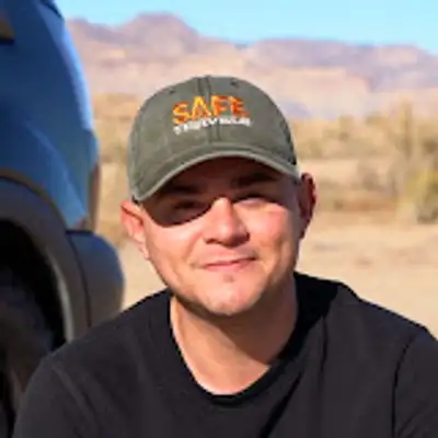
Hi, everyone. Thanks for checking out the Safe Travels Podcast. My name is Joey. Today, are on the banks of the Green River in Northeastern Utah, just inside Dinosaur National Monument, and I'm honored to be joined by Dusty Perkins. Dusty is the Program Manager for the National Park Service's Northern Colorado Plateau Inventory and Monitoring Network and a lead scientist on the Big Rivers Monitoring Project.
Speaker 1:In this episode, we explore the beauty and significance of the Green And Yampa Rivers as well as the overall health of the major river systems across the Colorado Plateau. Dusty, we have the beautiful Green River behind us and I'm grateful for your time today. So thanks for joining the podcast.
Speaker 2:Yeah. Thanks for having me on.
Speaker 1:You've been with the Park Service since 2007 as a network program manager. But you have a degree from the University of Maine as a wildlife ecologist. Why the love for wildlife and did you always wanna work for the National Park Service?
Speaker 2:I wouldn't say I always wanna work for the National Park Service but pretty early on junior high, high school, something like that. Like I loved hunting, fishing, camping, running, whatever, all these things outdoors and just thought that if I love those things I should work to try and help protect them. So yeah, I went to school for wildlife. This job is kind of morphed into some different things but still a general ecological, biological implications and how we can help improve things.
Speaker 1:You play a crucial role in the inventory monitoring program and specifically focus on the Big Rivers Project. Can you break down what the inventory monitoring program is and then of course what the Big Rivers Project is?
Speaker 2:Yeah. So the inventory monitoring program is now almost twenty five years old or so and we were put in place to give scientific information to park managers to make decisions. Basically, when a chief of resources left a park, lot of information went with that person, and our job was to really keep that job, be the key holders, and put a lot of work into data management and things like that. So yeah, we have 11 different protocols for 16 different parks and it's all all information that the parks can make better decisions with.
Speaker 1:And with the Big Rivers Project, what specifically do you focus on? Is there a specific subset of rivers that you're most focused on?
Speaker 2:Yeah. So we have the Northern Colorado Plateau Network which is parks in the Upper Colorado River Basin. So we have three parks that we do this at. Dinosaur National Monument, which has the Green And the Yampa Rivers. Then this flows downwards to Canyonlands National Park on the Green River, and so we monitor the Colorado and the Canyonlands, I mean Colorado and the Green River in Canyonlands National Park and then if you go up the Colorado River, we have Black Canyon and the Gunnison National Park and we monitor the Gunnison River that eventually flows into the Colorado and then all the rivers come together in Canyonlands.
Speaker 1:Right before this podcast, right before we sat down, you came up with your team on some rafts and you were out on nearly a week long trip. What was that trip that you were on?
Speaker 2:Yeah. So that's our annual swift water rescue training. I mean, we're in the water all the time. We're rafting through some pretty technical rapids that there have been some mishaps in the past from either the public or government people. So every year we do a six day trip that's a swift water rescue training where we're doing a lot of the stuff, simulating some of the same work that we do in terms of wading and do a bunch of different wades, but also self rescue and rescuing others that might be part of our team or members of the public because we're floating down.
Speaker 2:And the skills have come in useful from time to time over the twenty years or so that I've been involved.
Speaker 1:You mentioned that's an annual trip. How often are you out on the rivers for science reasons and and part of this inventory monitoring program?
Speaker 2:So we do, let's see, about five or six river trips a year. We do one annual monitoring trip in Dinosaur Canyonlands and Black Canyon Of The Gunnison. That is our big river monitoring. We do an additional river monitoring trip here for invasive plant monitoring. And then the swift water rescue trip, and then sometimes there's other kind of science collaborative trips that will go on either to inform decision makers about what's going on and things like that.
Speaker 2:But yeah, somewhere in the neighborhood of five to six river trips a year.
Speaker 1:Are you partial to any specific river being out and rafting? Are there any ones that are more technical that you enjoy or that you just cherish being on?
Speaker 2:It's tough. I mean, all all three of those parks are really special places. I think the Yampa because it is wild, it's the last largest relatively unregulated, there's there's a couple dams up there but relatively unregulated in Wild River and that's a pretty special thing to be out on that river and actually see, that's kind of the reference point for what rivers, desert rivers should look like.
Speaker 1:That leads me perfectly into my next question and the conversation that I wanna have with you is, you had mentioned the Yampa runs through Dinosaur National Monument where we are right now, as does the Green River which I had mentioned is directly behind us right now. The Yampa runs into the Green River at Echo Park which is in Dinosaur National Monument. But what is the major differences between Yampa as you had mentioned being relatively unregulated versus the Green River which is dammed. How have they been affected in different ways by one being wild and one being highly regulated?
Speaker 2:Yeah. So I'll go back even a step further. Dinosaur is an amazing spot to work. And it's amazing because you've got those two rivers and then they come together and they're a combination of those two rivers. So and the Yampa the Green is highly regulated by Flaming Gorge Dam and the Yampa River is has a has a couple of dams on it but they're generally run of the river so they can't store a lot of water.
Speaker 2:Flaming Gorge can store up to three years of annual flow behind that dam. So it it really it kind of alters the flows of those rivers. But in this park, you've got the Green and the Emperor River with almost the same watershed size, so where all the water's coming from and almost the same mean annual flow. So they're pretty identical rivers and they come together. It's like you couldn't you couldn't have set that experiment up better in a lab.
Speaker 2:It's like a in a lab you would do flumes and then you can control everything and this is almost perfect. And then when the Yampa comes into the green, it partially restores the green river back down through. So some of the differences, I mean, they're they're pretty enormous. When the dam was put in, it does what dams do. It was generating hydroelectricity power so and that was the sole reason for that river.
Speaker 2:So it was basically a flight flat hydrograph. And what's that mean is they kept the water at basically the same level all year round. Where a natural river would have a spring peak that's coming from the snow melt and then it would go to a lower base level. And obviously if you're getting the springer off now, that's not when people need energy for air conditions and things like that. So from a dam perspective, from a hydroelectric, it's better to keep that flat.
Speaker 2:But all of the plants, the species are all adapted for thousands of years to that spring snow melt hydrograph. It gets really high and then gets much warmer in the summertime. And temperature, so the temperature of the dams, cold water falls. The warmest water is on top and the cold water and you can't Originally, the dam could not change the level of the water, so we get a lot colder water in the summertime, much colder water than the Yampa River in the summertime and actually a little bit warmer in the wintertime because it was still coming from that same spot. So on the Yampa you can get a spring peak flow of about 30,000 CFS cubic feet per second So that's a really big flood.
Speaker 2:This year it'll probably only be about three or 4,000. It may have already happened. We're not sure. There's not that much snow left in the river system. The green used to do that and now but now power the max they will let out before it would hit the emergency spillway is 8,600 CFS and they used to get to 30,000 CFS.
Speaker 2:So that's a lot lower spring peak flow than than historically occurred. It's still, they still simulate it so we get that 8,600 or so every year, this just depends how long it's gonna be. That spring reset event that the Yampa still has that Ladore doesn't have is really critical to resetting everything. Generally in lower flow years vegetation starts to encroach and in those higher flow years either the scour of the river, the power of the river washes those vegetation out or just pure inundation like if things are underwater vegetation will will die or some vegetation will. So that's one thing.
Speaker 2:It's just this that spring peak runoff, the temperature. So a lot of the fish and the invertebrates are keyed into those temperature things. And we actually just this week, the fish and wildlife service people I believe detected larval stages of pike minnow. So that's why next week this river will go up to 8,600 to kind of simulate that spring flow and help those fish out. And then another big thing is the sediment.
Speaker 2:These rivers should be kind of brown and dirty. That's a desert river. There's a lot of sediment in there. They're not like your pretty Rocky Mountain or New England or Northwest streams. They're they're supposed to be brown and and kind of muddy looking.
Speaker 2:And when you but when you get behind a dam, the water slows down so all that sediment drops out. So yeah, sediment, temperature, and lack of a high spring spring runoff are really the three big things. And I guess I'd add a fourth one to that is the variability of the summer flow where again on the Yampa you could have, know, this summer it might get down to 50 or a 100 CFS, really low flows, but it could be in July 2,000 CFS where the green is generally in around the 800 to 1,600 CFS level every summer. So it's kind of it results in some stabilizing of vegetation. So I covered a lot there and went all over the place, but yeah.
Speaker 1:Just to clarify there, the the Green River is more consistent in the summertime because there's a reservoir of three years that they can tap into and and regulate the stream year by year.
Speaker 2:Yep. And they they wanna keep the flows for the for energy development and also wanna keep the flows, I mean, for recreational boaters, it's great. You can always float Ladore in the summertime. You cannot always float the Yampa in the summertime with your raft. So there's there's pluses and minuses to that system for sure.
Speaker 1:Does the dam ever release water to help cycle natural events? You mentioned the the larva that was found and when things are found like that, they do utilize the dam for ecological benefits.
Speaker 2:Yeah. So there's there's four endangered fish in the Collider Upper Collider River program, Upper Collider River Basin. I'm not a fish biologist but I kinda know the basics of it. And so I mentioned like in the sixties as soon as that dam was closed it was a flat hydrograph so it was that year round. But then they realized that the fish needed some help.
Speaker 2:So since that time and because of the Endangered Species Act we've added some components to simulate that natural flow. So now every year there is at least that spring peak of 8,600 CFS that is the max they can let out without going over through the emergency spillway And then they've also put in a temperature gauge so we can now adjust the temperature a little bit better. And there's actually a pretty interesting story with mayflies. So pre dam, there were 17 different species of mayflies on both the Green River and the Yamper River. They're all still there on the Yamper River.
Speaker 2:They were a mix of kind of mountain species desert species and actually great plain species from pre glaciation. Not the same species but tightly related. And so they both had 17 species, there was a guy and I can't remember the name who did some work and found both those species and mayflies are a species that are a good indicator of good water quality, they're one of the key taxa to look at for good water quality. So as soon as the dam went in, the green went down to one species. They had one species of mayfly left and all 17 were still on the Yampa.
Speaker 2:And then I won't get the exact numbers right but when they started to simulate a spring peak flow, we got three or four of those species back. And then when they put in the temperature regulation, we got two or three species back. So I think now there's seven or eight species of mayfly on the Green River and 17 still on the Yampa, but the ones we're now missing on the Green are the ones that are tied to the sediment, the detritus woody woody material. So they eat that or they need that for their life cycle and it's just it's not there on the Green River. So it's kind of a neat story of, yeah, there's there's some components we can simulate, but there's other components that we I mean, you couldn't you couldn't drive Macs Mac trucks in there nonstop with loads of sediment to match what's in the river.
Speaker 2:It's just it's an enormous amount of sediment that gets trapped behind the dam as the water slows.
Speaker 1:With the sediment that's getting trapped behind the dam, does that also affect the morphology downstream of of how maybe the river is eroding and and constantly carving out these river ways?
Speaker 2:Yeah, for sure. And there's been a lot of good studies in Ladore River. Jack Schmidt and Utah State University in his lab have done some really good stuff in there. And again, I'm not a geomorphologist but I'll do my best to simulate one. And basically what's happened is they've lost a lot of sediment that's been trapped down there.
Speaker 2:So in general over time, the river has deepened that channel because it's evacuated sediment, flush sediment downstream that hasn't really been replaced. And then in combination with not having those wild flows that would scour vegetation, the vegetation is kind of encroached and as it does that it armors the banks, it makes it even harder to scour sediment out. So now you've got kind of these flood plains that used to be flood plains that are never inundated and even if they were they'd be much harder to scour out and so those that old floodplain is now disconnected from the river channel. And that's actually where we see a lot of the really large tamarisk because there's actually a really big flow right before the dam shut water off and so those tamarisk and an exotic species could become established and then they never really were gonna get flooded out again. So that that's why we have a decent number of tamarisk in Ladore Canyon is one of the many reasons.
Speaker 2:Yeah.
Speaker 1:Earlier in the podcast you had mentioned that these fish in the vegetation in these rivers have been adapted for thousands of years to the conditions that are occurring in these rivers. Have you seen in the monitoring program changes to that since the dam has been installed for the Green River?
Speaker 2:Yeah. I mean, all of the fish species are adapted to those murky desert waters and they all several of them have a hump right behind their neck. They're kind of fish that only a mom could love. They're not the most attractive species. And there's there's some thought that that helps them stabilize in these no nobody really knows but some thought that that might help stabilize them.
Speaker 2:But yeah, I mean the the fish are still endangered so they're still not in good good places and there aren't many in Ladore Canyon. They start to come back to the river because of the Yampo and it combines at the confluence and they the the pike minnows still do spawn in the Yampa River, but I don't I don't think any of the endangered native fish spawn in Ladore Canyon.
Speaker 1:And you're over two decades with the monitoring programs in The United States. What are some of the the big changes that you've seen specifically in the Northern Colorado Plateau network?
Speaker 2:I'll start with good news. I mean, generally, the parks are our most protected places in this country. A lot of times, they are kind of our reference scenario, things that other scientists will say, what what should the ecosystem look like? And they'll often go to some of these parks. So some of our parks are still in really good shape.
Speaker 2:I think if we're talking, you know, if we're talking rivers, I think the continued vegetation narrowing is something we see kind of almost everywhere. We we kind of don't see it as much, actually, ironically, right before below Ladore Canyon and maybe in Black Canyon as well because it is stabilized so the the narrowing has already happened. But in stretches of river down through Canyonlands, we're still seeing a lot of that vegetation narrowing happen primarily through Willow but also with some Tamarisk as well. Some of the other changes, I mean, we continue to see things change like with aridification. Just we're we're in a drier climate now and it's and it's some shifting of some of the species that respond to those things.
Speaker 2:Our birds are in are are relatively good. Think the last one we had more increasing trends and decreasing trends and then a bunch of species that didn't have a significant trend, so that kind of indicates stability. There are some some birds like pinion jay is one that's of concern right now that we don't actually monitor, but we're doing some inventory work on. Water quality for the most part in the in the program in in these parks is is relatively in good shape. I think, you know, we're in the we do thousands of evaluations a year against multiple criterias, and it's, you know, above 98, 99%, it's really high.
Speaker 2:There are some problem areas and the gratifying part of this is our work goes straight to management. So we've been able to kind of give people some problem areas and then work with them to increase monitoring and see how some of the park management changes have been in fix those problems.
Speaker 1:You had mentioned vegetation narrowing both in Black Canyon and other areas. What do you what exactly do you mean by vegetation narrowing?
Speaker 2:Yeah. And vegetation narrowing is what a lot of people will say and I I slipped up and that's that's a piece of it but it's not only narrowing, it's actually channel simplification. So we in the Park Service, we want a wild river and a wild river has back channels, it has backwaters, like little places that are different niches for plants and animals. Generally, if you looked on a, if you did a graph of all the rivers in the world, the more water flow you have, the wider the river's gonna be. That's the simple thing.
Speaker 2:And and that's kind of intuitive to most people, right? But those resetting events are really important to restore those backwaters because in a there's no there's no perfect flow for rivers really respond and have been adapted to variability of flows over the course of the year. So yeah, the vegetation is is the thing that responds to the sediment and in some cases it's kind of a self enforcing loop, reinforcing loop. Because once the sediment is there then it slows down the water and then sediment can can will continue to drop out. The slower the water, the finer the sediments are gonna drop out.
Speaker 2:One of the interesting things is the tamarisk versus the native species. Tamarisk is a non native and things like willow and cottonwood are native species. And both those, willows when they're young, there's some right I mean, some cottonwoods right behind us, they will bend over in the flow. Where tamarisk is a different species and it kind of is stout and will stay there. So it ex tamarisk actually does better job at slowing the sediment, the river down and therefore dropping sediment out.
Speaker 2:So both those things as the vegetation comes in, often the first thing to narrow or simplify is those back channels that are really important to fish and really important to invertebrates and to plants.
Speaker 1:And why are those back channels so important to them?
Speaker 2:Diversity is what supports a native river system. So if we had a straight channel, I mean that you can imagine like an irrigation canal in a place that's irrigating for crops, oftentimes those are concrete and there's just nothing there. It's simple and they don't want anything to grow there because the the means is to convey vegetation, but there's no habitat there versus a wild river, the more habitats that you are, the more species you're gonna have and generally over science and ecology, the more species you have in a system, the more stable it is, the more resilient. So when you get those disturbances it can bounce back. If you just have one or two species and you know a new insect comes in or something like that and it takes away that that species there's nothing to replace it in a so more complexity means more diversity is generally is more stability, more resilience.
Speaker 1:At the confluence of the Green and the Colorado River, is there any drop off with species that are able to maybe thrive in the Green but maybe don't do as well in the Colorado or are the river systems so similar that they're generally able to survive once they get to that confluence?
Speaker 2:Yeah. No. I think they're I would say they're pretty similar there. I mean, the the species like the Colorado Pike Minnow, they, you know, they'll range hundreds of miles in the course of their life cycle and they would go up the Colorado, up the green originally makes makes makes no difference. So I can't think of a species that's only on the green, only on the Colorado.
Speaker 1:How have invasive plant species played a role in changing these river systems over time?
Speaker 2:Yeah. So I mean, tamarisk is a big one. It was originally brought in by the US government to help stabilize things and and it's pretty good at that that very task. So the tamarisk, as I mentioned, one of the things it's done is it's it's really encroached upon the river and simplified things and then once it's there it is stout so the sediment drops out and continues to reinforce itself with those big flows because then it's really hard. Once you get above three or four years for any woody vegetation, whether it's tamarisk or cottonwood, it gets a lot harder for the river to re scour and scour that
Speaker 1:vegetation out. So would that be one of the situations where you would submit to management a management plan? Is is that a plant species that you would diagnose a plan to get rid of or a management plan to help the river or do you let that invasive species be?
Speaker 2:I mean, right now with tamarisk, the the the park has actually done a really good job in releasing tamarisk beetles and that'll probably never get rid of the tamarisk but it will hopefully keep them at a lower baseline. But without restoring the historic flows, like we really don't have a shot at eliminating tamarisk altogether. We can minimize it and on the Yampa River, cottonwoods and willows can compete pretty well with tamarisk when it's a natural hydrograph. So you on the Yamper River there's not a lot of not as many tamarisk as there is in the Dore Canyon. So we kind of call it the green, the yampa, then something in between.
Speaker 2:So the green is the most number invasive species, the yampa there's the least, and the green is literally kind of a hybrid between those two rivers. So basically, and I mean, the natural flows would help restore the system but, know, with society's needs on water and whatnot we can only kind of eliminate tamarisk in key spots. The park here has done a great job in removing tamarisk from a spawning bar, Cleopatra's couch for pigment on the Yampa River. So I think things like that we can we can have success. But as far as getting rid of tamarisk or Russian olive across the whole system, right right now with what we know that we really can't do that.
Speaker 1:As we mentioned we're at Dinosaur National Monument and one of the reasons why this national monument is so special is because the Green River has carved out these beautiful canyons and has exposed dinosaur bones for thousands if not millions of years and researchers have flocked to this area to study these dinosaur bones. But because these flows aren't at their natural levels, I assume they're carving less and exposing less, is that correct?
Speaker 2:Yeah. So it's it's interesting, a lot of it depends, right? It depends on the kind of rock. If we're talking about you know really hard rock in Lidore Canyon that's really old rock, it probably has not perceptibly I think in the big scheme of things sure we if we could measure things down to millimeters more more flow generally means more carving, more scouring. But where you do see that difference is like colluvial deposits and what I mean by colluvial are things that fall from the canyon sides or a side canyon that flushes water into the from a from a summer rain event.
Speaker 2:And like in Black Canyon Of The Gunnison, we saw some flows in 2017 that were the highest flows since that dam had put in place and so places were getting wet that hadn't been wet since pre dam. And that really did kind of scour out some of those colluvial deposits. Things that a big rainfall event comes and a bunch of rock and gravel comes down and it just sits there. And if you don't have the power to clear that out then that'll contribute to that channel simplification and channel narrowing. So as we have less flows, less power, you know, we still more or less have those scouring events on the Yampa but we don't get those high flow events on Flaming Gorge or in Black Canyon with Gunnison right below the dams.
Speaker 1:Obviously, this year, it's well documented that snowpack is down in states all throughout the West. Does that concern you in terms of the level of flow that could occur in the in the Yampa this year with less meltwater feeding the headwaters?
Speaker 2:Yeah. I think it's it's definitely a concern and it's a concern for us and there's less water just to go around. So a few years ago, I think it was sometime in the teens, there there were some calls on the water which means the people that had older water rights were making sure their water right was filled before more junior water rights came along. And so there there could be more taxing of the system. The snowpack is one of the lowest we've seen on record for the Yampa River.
Speaker 2:I think maybe 2002 was a similar year, was another really low year. But again, we only have really good snowpack records for the last forty, fifty years or something like that. So we don't know the full range of what might have happened, but this is certainly kind of unprecedented in the last fifty to a hundred years where we've really had some good scientific data. We've never seen this low a snowpack and basically the the the runoff is more or less done where usually it's just kind of ramping up right now. Rivers are adapted to variability and desiccation drying out can actually kill vegetation too.
Speaker 2:So particularly younger seedlings. And 2011 was our last really big spring runoff and then we had a really dry year, 2012, right after that. And that one two punch kind of also helped with scouring of vegetation. No new vegetation came in 2011 because it was a really dry right after that. So yes, it'll be interesting and perhaps concerning to see what this low of flow does but it will really depend on you know what what next year does and the year after that.
Speaker 1:I was gonna ask because of the records not showing this low of snowpack maybe since 2002, is this an important year for you and your team to understand the impacts downstream of of having this low FO and this low snowpack?
Speaker 2:Yeah. I mean, think what's really important and what's really great about the inventory monitoring program is for most most programs that vital signs is what we monitor is what we call them. Most vital signs we monitor annually and if you don't do it annually, you can't really say it was that year that did this event. So yeah, think it's I think I mean, every year seems like it's important to monitor but this in particular is an is an outlier, a year we haven't seen this low in since we started in around 2010, 2011 is about when we started this river monitoring program.
Speaker 1:I've heard these programs labeled as its annual physical from a doctor. You're Yep. One of the doctors for the park and you're monitoring the park and and doing the the annual physical, how important is it, you just alluded to it, but is long term monitoring and not having a gap in your dataset to be able to point to downstream effects? I mean ultimately those downstream effects can affect humans based on the dam and just low water levels. But just in general, all the ecosystems that you're you're speaking for and giving a voice to, is it crucial to not have a gap in that dataset?
Speaker 2:Yeah. I mean, you want you don't want those gaps. Like I said, if you you can't really definitively say that it happened because of the low flow if we weren't out there this year. You could probably imagine scenarios where it might be a combination of flows over the last ten years. So it's really important to get out there annually.
Speaker 2:I think it's also really important just like, I mean, that's why we call ourselves why the the founders of this program did Vital Science because it's just that. So with invasive plants, it's really important to plants are much easier to monitor the smaller size they are. Once they get kind of out of control, there are a lot a lot more time and resources need to go in there. Things like water quality. We've had examples at Zion At The Narrows where a really popular hike and we detected high e coli levels which could then endanger park visitors.
Speaker 2:And then we were able to detect those, report those through the park, work with the state to kind of rectify those those problems. So yeah, the earlier managers can have information to make their decisions, the better off the system is. And annual monitoring is one of the hardest things to fund. It's not an easy thing. So it's really commendable that the Park Service has, and the US government has done that.
Speaker 2:There's there's really not another program like it as with this long history record anywhere in the world, really. We're pretty pretty special to have that monitoring program nationwide in all our national parks.
Speaker 1:You mentioned it that you work for the Northern Colorado Plateau Network. There's other networks all around the country. Do you work with those other networks when maybe, you know, a season like this year hits you and you need to contact an area that's typically more on the air dry climate side. Do you work with other networks to determine you know what could happen with the low snowpack and other variables?
Speaker 2:We work a lot with the other networks quite a bit actually. There's 32 networks nationwide. If we're talking rivers, so the Southern Colorado Plateau network is like us but in the Grand Canyon, USGS, the Grand Canyon Monitoring and Research Center actually does the river monitoring there so the network doesn't do it, the USGS does it for the park servers. But we collaborate and we've had their people have come up on our trips and we've gone on their trips. We're not doing it this year but most most years we collaborate on those and can work together to combine data sets.
Speaker 2:The more data points you have the better off you are. We also our river ecologist Luke Goverman, he's really good at surveying and it takes a long time to get somebody to that level so he actually goes and helps the Chao'an Desert Network and Big Bend National Park and does their river monitoring then. He's actually I think he's on the river right now. That's why he wasn't on this class. The the swift water rescue training class.
Speaker 2:So, yeah, there's a lot of collaboration in other things. So there aren't as many parks that have big rivers in the arid West, but like our upland monitoring, there's a group of five networks that kind of all collaborate on analyses and potentially could collaborate on a broader scale condition of what's what's the semi arid West doing in the national park.
Speaker 1:When you go out to do your science on these big rivers, can you take us on a on the day in life, what you're looking for and and how exactly you conduct your your research and your science when you're out?
Speaker 2:I love river trips. I mean they're they're one of my favorite things, it's usually, we usually have eight to 10 people or so on the trip and most of our trips are eight days on, six days off, that's what our crews work on because we travel long days so it's better for us to work long days, ten ten or so hour days to get work done once we're in a park because it just takes so much effort to get there. We wanna spend as much time as we can once we're in the park. And so yeah, we'll divvy up tasks. We've got sentinel monitoring sites, nine here in the park, and we'll hit those on two two separate trips.
Speaker 2:Sometimes we combine it into one big mega mega trip, so a sixteen day trip. And we'll hit those monitoring sites, so we'll wake up, there'll be botanists that are going to the plots, there'll be surveyors that are going to the taking the measurements of whether the the elevation, so the has it accreted, has it eroded, has it gotten higher or lower? And then we'll have people checking the transducers. That's I guess one part I didn't mention. We have transducers that are upstream and downstream of the site and they measure the weight of the water and then we know how much water weighs so then we can say, you know, this this plot of ground right here was underwater for thirty days versus that plot up there up higher was only underwater for ten days.
Speaker 2:So we have people and then we have photos. Photos can be really valuable to help explain all the science and some of the really great tools in in looking at long term monitoring. It's great to have all the data points but sometimes a picture can really convey your message just as well. You need to have the science behind it so that you you're not, you know, you're not just picking a spot that wasn't random or things like that but having that combination is really really tight. So then we we're all working together.
Speaker 2:We have walkie talkies and radios that we're talking to each other to kinda make sure because we all need to move down the river at the same time. So you know, if there are some people that can do multiple tasks so so we're getting towards the end of the day, if botany's a little ahead of the surveying, maybe we'll send a botanist over to grab another rover and make sure we kind of all finish and move on downstream. I like them because they're just it's those eight or 10 people on that trip and you've got these sites to go to and that's all that really matters for that eight days and there's no I can't check my email, I can't check my voicemail. We do have in reaches now so we we have safety in place and can have some contact with the outside world but it's really those those 10 people in that job in those eight days.
Speaker 1:Is the rest of the year then unpacking your results and doing projecting and and compiling that data?
Speaker 2:Yeah. So I mean our our field crew we usually hire between ten and twelve people that go out and they're basically in the field from March through October. Now, and then eight days on six days off working on any of those 10 different protocols that I mentioned in 16 different parks. I usually get out on two or three of those a year, hitches we call them, eight day hitches, and then yeah, a lot of the rest of the year is, you know, things that everybody has to do. It's budget, it's hiring, it's, you know, analyzing the data.
Speaker 2:We spend a lot of time on data management to make sure the data is secure and that people can use it, whether it's us or somebody else, and getting reports out. The sooner we can get reports out to the parks, the sooner they have kind of solid, peer reviewed information to make management decisions.
Speaker 1:How big of an impact is human pollution in terms of recreation out on these rivers play a role in in your work or from what you've seen from monitoring, has it impacted these rivers at all or are they pristine from from that perspective?
Speaker 2:We're lucky because these parks are they're often higher in the watershed so they're above most of the major industrial areas. So the for the most part is I think I mentioned you know our water is pretty good. Interestingly enough we've done some work with wastewater indicators and those are things that that are new to the environment, things that we don't really know what their effect are. It could be from DEET, it could be from coffee, it could be some of those things. So we've we've started to explore those emerging indicators and it's been interesting seeing how widespread those are and we don't really know what some of those effects are and more importantly we don't know what the interaction of some of those
Speaker 1:different wastewater indicators are. You outlined a lot of the research that you do on these eight day hitches. Is there a specific area that you find particularly interesting to yourself? Any particular research that you get enjoyment out of?
Speaker 2:Yeah. I mean the the great thing about this program for me was I was a wildlife ecologist. So most of my work was with critters. And then I got this job, moved here and we had our wadeable streams protocol moving kind of smaller streams and rivers. We had birds going, we had uplands going, we had water quality going and no one had started the rivers.
Speaker 2:And this park was really adamant that we needed a big river program to come to and you know fluvial geomorphology. So that's how the sediment is moving because of flows, fluvial. And I was like fluvial what? Like I I didn't know anything. I really didn't I didn't know how to row boat, I didn't know basics geomorphology stuff and so coming into this program be like, this is yours, you have to start this.
Speaker 2:And Tamara Nauman who is the longtime botanist here organized two trips for me, one down the green and one down the Lidore where we had a bunch of these different scientists, riparian ecologists, botanists, geomorphologists, just to talk about how a monitoring program would look like and I went through the gates of Lidore at the start of this river trip and I just felt like so lucky. Like, I get to work here, like I get to form this, like how did I get to this? Like, don't know anything about the river. Obviously, they they thought the same thing. They thought it was a great trip.
Speaker 2:But it's it's an amazing place and Canyonlands and Black Canyon are equally amazing. This was just my first experience was here. Was just like, wow. I can be in this job a long time.
Speaker 1:I bet. And have you fallen madly about now with with rowing and being out in these rivers and you know, I mentioned that you're a doctor for these areas. Do you almost feel like a father too looking at these places that you have spent such intimate time with?
Speaker 2:Yeah. I don't know about a father. I mean I I there's some when you start a business, right, you want it to last but when you're an ecologist and you want kind of as minimum impact as you can. So you wanna monitor this place but hopefully we don't do any detriment to it. We had some new people on this trip who some had never been on a river trip before, some it's like maybe their first or set their second or third and to just see that excitement and we were talking about it the other day, was like this is one of my most favorite places in the entire world, it's like right here on this river and we're getting paid right now to do this.
Speaker 2:And a couple of the new people were just like, wow, this is amazing. When can I get on the next pitch? Can I go volunteer with the fish people and help them out? Can I volunteer with the park if I can't do a river trip with NCPN with the Northern Colorado Plateau Network? So it's it's really cool to see that be infectious and contagious and see other people's excitement because it is it's an amazing place, Dinosaur and as well as Canyonlands and Black Canyon.
Speaker 1:Would you say it's a different experience being on the river going through Dinosaur And Black Canyon than, you know, viewing it from, you know, up top at a viewpoint?
Speaker 2:Yeah, for sure. I mean, being on the river, the flows are flowing by, you're you hear the water, you smell it, you see it. As you get to rapids, you know, you can hear the excitement. It kinda you tense up because they are technical and they're they're they are dangerous but then the power of going through a rapid and making it to the bottom and seeing everybody smile and you know, kind of that release is is something that's really special.
Speaker 1:Since you've learned a lot of this on the job like rowing and and kayaking, is it now a side passion for you? Do you do it outside of work or do you keep that primarily just for your job?
Speaker 2:Oh, For sure. Yeah. I mean, I'd like I said, I'd done a little bit of canoeing on rivers but now our family trip, I'm gonna get my two boys, my wife, and it's generally a rafting trip. So we have our own all our own gear and yeah, it's something that they love. Yeah.
Speaker 2:And love to be on the river as much as I do.
Speaker 1:So these parks and these rivers changed your life in a lot of ways.
Speaker 2:Yeah. I would say so.
Speaker 1:Yeah. It's pretty special and I'm sure you're getting a good kick out of seeing these folks roll up to the boat dock and and yelling and having a great time after their trip. I'm sure it brings you good joy to know that the river as you mentioned earlier in the podcast is healthy and people are out here enjoying it.
Speaker 2:Yep. Yeah. It's great great to see people out enjoying national parks.
Speaker 1:Well, just wanna give you the the floor to to say anything that we haven't said yet or give people one final piece of encouragement to come visit Dinosaur National Monument or visit the the Yampa or the Green Rivers.
Speaker 2:Yeah. I mean if you can't get out to Dinosaur, get out to wherever you are. Get on a river, hike a trail, climb a mountain, all those things. It's it's good for the soul, it's good for your physical health, your mental health, get outside.
Speaker 1:I guess the final thing I'll say is you've done a lot of amazing work, lot of amazing science and research and a lot of this is published for people to see. How would you encourage people to engage with the science and research you've done and get to know these parks before coming to them in a way by learning your research to to understand what they're what's going on in these parks before they they arrive here and invest in the in the work that the Park Service has done to display this information to the public?
Speaker 2:Yeah. Mean we have a very long nationalparkservice.gov account but the easiest way to find it is just to Google Northern Colorado Plateau network. Think usually if you Google Northern Colorado Plateau it'll pop up too and once you're on there there's sections on each park so you can kinda go by park to see what we found. And then there's links to the park science pages on there as well, so there's lots of ways to deep dive deeper. And then if you're interested in a network in another part of the country, right on our homepage, think down at the bottom you say find your network and you can find a network.
Speaker 2:There's 32 networks like this around the country so there's a network covering your region. So yeah, get in there and dig and explore and you can look at the reports, you can look at the data, you can look at web articles or summaries and find out what's been going on. Well, thank you
Speaker 1:so much for your time. Had a blast chatting with you and more importantly, thanks so much for all your work and and research and you know, protecting these places and being their doctor. It's doesn't go unnoticed. I appreciate Great.
Speaker 2:Thanks for having me.
Speaker 1:Thanks so much for checking out this edition of the Safe Travels Podcast. I really hope you enjoyed it. Dusty is doing incredible work as the doctor for the Green And Yampa Rivers, and I truly hope you get the opportunity to explore these iconic tributaries of the Colorado River. If you like this type of content, it mean a whole lot to me if you followed or subscribed as it really does help out our podcast. And until next time, safe travels.